Ghanzi geodata
Ghanzi is a seat of a first-order administrative division; located in Botswana in Africa/Gaborone (GMT+2) time zone. With population of 9,934 people, there are 19 cities with bigger population in this country. Compared to other cities in Botswana, 74.3% of cities are located further ↓South; 98.1% of cities are located further →East and 85.7% of cities have lower elevation than Ghanzi. Note1


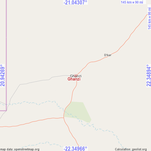
Ghanzi GPS coordinates[2]
21° 41' 52.26" South, 21° 38' 44.916" East
| Map corner | latitude | longitude |
|---|---|---|
| Upper-left | -21.04307°, | 20.94269° |
| Center: | -21.69785°, | 21.64581° |
| Lower-right: | -22.34966°, | 22.34894° |
| Map W x H: | 145.3×145.3 km | = 90.3×90.3mi |
| max Lat: | -17.80165° ⇑25.7% North |
| Ghanzi: | -21.69785° |
| min Lat: | ⇓74.3% South -26.9° |
| min Long | Ghanzi | max Long |
| 20.06667° | 21.64581° | 28.74946° |
| W 1.9%⇐ | ⇒98.1% E |
Elevation
Elevation of Ghanzi is 1144 m = 3753 ft, and this is 129 m = 423 ft above average elevation for this country.
| Max E: |
1406 m = 4613 ft | 14.3% |
| Ghanzi | 1144 m 3753 ft | |
| Avg. | 1015 m = 3330 ft | |
Min E: |
676 m = 2218 ft | 85.7% |
See also: Botswana elevation on elevation.city.
Geographical zone
Ghanzi is located in South Torrid zone (between Equator and Tropic of Capricorn). Distance of this Southern Tropic circle is 193.3 km =120.1 mi to South.| Distance of | km | miles | from Ghanzi |
|---|---|---|---|
| Equator | 2412.6 | 1499.1 | to North |
| Tropic Capricorn | 193.3 | 120.1 | to South |
| Antarctic Circle | 4988.6 | 3099.8 | to South |
| South Pole | 7594.5 | 4719 | to South |


Nearby cities:
15 places around Ghanzi: (largest is in red/bold)
• Dekar
34.9 km =21.7 mi,  58°
58°
• Hukuntsi
256.2 km =159.2 mi,  176°
176°
• Kang
249.1 km =154.8 mi,  151°
151°
• Kuli
221.3 km =137.5 mi,  227°
227°
• Lehututu
253.3 km =157.4 mi,  174°
174°
• Lokwabe
275.2 km =171 mi, 175°
• Manyana
189.4 km =117.7 mi, 177°
• Maun
265 km =164.7 mi,  43°
43°
• Mopipi
339.9 km =211.2 mi,  80°
80°
• Nokaneng
234.9 km =146 mi,  15°
15°
• Rakops
291 km =180.8 mi, 75°
• Sehithwa
176.3 km =109.5 mi, 39°
• Toteng
199.2 km =123.8 mi, 42°
• Tsau
191.3 km =118.9 mi,  25°
25°
• Tshane
261 km =162.2 mi, 174°
Sources, notices
• [Note1] Compared only with cities in Botswana existing in our database
• [Src1] Map data: © OpenStreetMap contributors (CC-BY-SA)
• [Src2] Other city data from geonames.org with taken over terms of usage.
• [Src3] Geographical zone / Annual Mean Temperature by Robert A. Rohde @ Wikipedia
