Dekar geodata
Dekar (Ghanzi) is a populated place; located in Botswana in Africa/Gaborone (GMT+2) time zone. With population of 1,043 people, there are 83 cities with bigger population in this country. Compared to other cities in Botswana, 75.2% of cities are located further ↓South; 90.5% of cities are located further →East and 82.9% of cities have lower elevation than Dekar. Note1


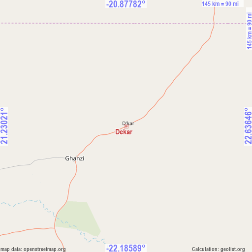
Dekar GPS coordinates[2]
21° 31' 59.988" South, 21° 55' 59.988" East
| Map corner | latitude | longitude |
|---|---|---|
| Upper-left | -20.87782°, | 21.23021° |
| Center: | -21.53333°, | 21.93333° |
| Lower-right: | -22.18589°, | 22.63646° |
| Map W x H: | 145.4×145.4 km | = 90.3×90.3mi |
| max Lat: | -17.80165° ⇑24.8% North |
| Dekar: | -21.53333° |
| min Lat: | ⇓75.2% South -26.9° |
| min Long | Dekar | max Long |
| 20.06667° | 21.93333° | 28.74946° |
| W 9.5%⇐ | ⇒90.5% E |
Elevation
Elevation of Dekar is 1139 m = 3737 ft, and this is 124 m = 407 ft above average elevation for this country.
| Max E: |
1406 m = 4613 ft | 17.1% |
| Dekar | 1139 m 3737 ft | |
| Avg. | 1015 m = 3330 ft | |
Min E: |
676 m = 2218 ft | 82.9% |
See also: Botswana elevation on elevation.city.
Geographical zone
Dekar is located in South Torrid zone (between Equator and Tropic of Capricorn). Distance of this Southern Tropic circle is 211.6 km =131.5 mi to South.| Distance of | km | miles | from Dekar |
|---|---|---|---|
| Equator | 2394.3 | 1487.7 | to North |
| Tropic Capricorn | 211.6 | 131.5 | to South |
| Antarctic Circle | 5006.9 | 3111.1 | to South |
| South Pole | 7612.8 | 4730.4 | to South |


Nearby cities:
15 places around Dekar: (largest is in red/bold)
• Ghanzi
34.9 km =21.7 mi,  238°
238°
• Hukuntsi
274.6 km =170.6 mi,  183°
183°
• Kang
253.8 km =157.7 mi,  159°
159°
• Kuli
255.6 km =158.8 mi,  228°
228°
• Lehututu
270.6 km =168.1 mi, 181°
• Lokwabe
293 km =182.1 mi, 182°
• Manyana
208.7 km =129.7 mi,  186°
186°
• Maun
231.3 km =143.7 mi,  41°
41°
• Mopipi
307.9 km =191.3 mi,  82°
82°
• Nokaneng
210.4 km =130.7 mi,  9°
9°
• Rakops
257.8 km =160.2 mi, 77°
• Sehithwa
143.8 km =89.4 mi,  34°
34°
• Toteng
165.8 km =103 mi, 39°
• Tsau
162.9 km =101.2 mi,  19°
19°
• Tshane
278 km =172.7 mi, 180°
Sources, notices
• [Note1] Compared only with cities in Botswana existing in our database
• [Src1] Map data: © OpenStreetMap contributors (CC-BY-SA)
• [Src2] Other city data from geonames.org with taken over terms of usage.
• [Src3] Geographical zone / Annual Mean Temperature by Robert A. Rohde @ Wikipedia
