Kachikau geodata
Kachikau (Chobe) is a populated place; located in Botswana in Africa/Gaborone (GMT+2) time zone. With population of 961 people, there are 88 cities with bigger population in this country. Compared to other cities in Botswana, 98.1% of cities are located further ↓South; 78.1% of cities are located further →East and 70.5% of cities have higher elevation than Kachikau. Note1


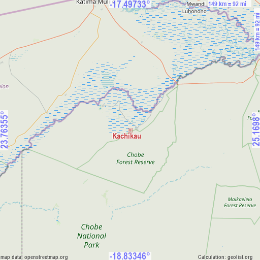
Kachikau GPS coordinates[2]
18° 10' 0.012" South, 24° 28' 0.012" East
| Map corner | latitude | longitude |
|---|---|---|
| Upper-left | -17.49733°, | 23.76355° |
| Center: | -18.16667°, | 24.46667° |
| Lower-right: | -18.83346°, | 25.1698° |
| Map W x H: | 148.6×148.6 km | = 92.3×92.3mi |
| max Lat: | -17.80165° ⇑1.9% North |
| Kachikau: | -18.16667° |
| min Lat: | ⇓98.1% South -26.9° |
| min Long | Kachikau | max Long |
| 20.06667° | 24.46667° | 28.74946° |
| W 21.9%⇐ | ⇒78.1% E |
Elevation
Elevation of Kachikau is 943 m = 3094 ft, and this is 72 m = 236 ft below average elevation for this country.
| Max E: |
1406 m = 4613 ft | 70.5% |
| Avg. | 1015 m = 3330 ft | |
| Kachikau | 943 m = 3094 ft | |
Min E: |
676 m = 2218 ft | 29.5% |
See also: Botswana elevation on elevation.city.
Geographical zone
Kachikau is located in South Torrid zone (between Equator and Tropic of Capricorn). Distance of this Southern Tropic circle is 586 km =364.1 mi to South.| Distance of | km | miles | from Kachikau |
|---|---|---|---|
| Equator | 2019.9 | 1255.1 | to North |
| Tropic Capricorn | 586 | 364.1 | to South |
| Antarctic Circle | 5381.2 | 3343.7 | to South |
| South Pole | 7987.1 | 4963 | to South |


Nearby cities:
15 places around Kachikau: (largest is in red/bold)
• Dukwe
337.7 km =209.8 mi,  142°
142°
• Gweta
238.2 km =148 mi,  160°
160°
• Kasane
83.8 km =52.1 mi,  61°
61°
• Kavimba
21.8 km =13.5 mi,  40°
40°
• Maun
230.2 km =143 mi,  208°
208°
• Mopipi
338.2 km =210.1 mi,  172°
172°
• Nata
290.6 km =180.6 mi, 141°
• Nokaneng
285.2 km =177.2 mi,  234°
234°
• Pandamatenga
128.9 km =80.1 mi,  108°
108°
• Rakops
317.7 km =197.4 mi,  182°
182°
• Sehithwa
314.8 km =195.6 mi,  215°
215°
• Shakawe
278 km =172.7 mi,  265°
265°
• Sua
277.5 km =172.4 mi, 138°
• Toteng
293.4 km =182.3 mi, 212°
• Tsau
305.8 km =190 mi, 223°
Sources, notices
• [Note1] Compared only with cities in Botswana existing in our database
• [Src1] Map data: © OpenStreetMap contributors (CC-BY-SA)
• [Src2] Other city data from geonames.org with taken over terms of usage.
• [Src3] Geographical zone / Annual Mean Temperature by Robert A. Rohde @ Wikipedia
