Rakops geodata
Rakops (Central) is a populated place; located in Botswana in Africa/Gaborone (GMT+2) time zone. With population of 5,222 people, there are 28 cities with bigger population in this country. Compared to other cities in Botswana, 81% of cities are located further ↓South; 79% of cities are located further →East and 81% of cities have higher elevation than Rakops. Note1


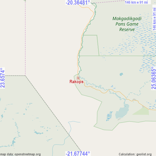
Rakops GPS coordinates[2]
21° 1' 21.252" South, 24° 21' 37.872" East
| Map corner | latitude | longitude |
|---|---|---|
| Upper-left | -20.36481°, | 23.6574° |
| Center: | -21.02257°, | 24.36052° |
| Lower-right: | -21.67744°, | 25.06365° |
| Map W x H: | 146×146 km | = 90.7×90.7mi |
| max Lat: | -17.80165° ⇑19% North |
| Rakops: | -21.02257° |
| min Lat: | ⇓81% South -26.9° |
| min Long | Rakops | max Long |
| 20.06667° | 24.36052° | 28.74946° |
| W 21%⇐ | ⇒79% E |
Elevation
Elevation of Rakops is 918 m = 3012 ft, and this is 97 m = 318 ft below average elevation for this country.
| Max E: |
1406 m = 4613 ft | 81% |
| Avg. | 1015 m = 3330 ft | |
| Rakops | 918 m = 3012 ft | |
Min E: |
676 m = 2218 ft | 19% |
See also: Botswana elevation on elevation.city.
Geographical zone
Rakops is located in South Torrid zone (between Equator and Tropic of Capricorn). Distance of this Southern Tropic circle is 268.4 km =166.8 mi to South.| Distance of | km | miles | from Rakops |
|---|---|---|---|
| Equator | 2337.5 | 1452.5 | to North |
| Tropic Capricorn | 268.4 | 166.8 | to South |
| Antarctic Circle | 5063.7 | 3146.4 | to South |
| South Pole | 7669.6 | 4765.7 | to South |


Nearby cities:
15 places around Rakops: (largest is in red/bold)
• Dekar
257.8 km =160.2 mi,  257°
257°
• Dukwe
219.2 km =136.2 mi,  77°
77°
• Gweta
130.2 km =80.9 mi,  44°
44°
• Letlhakane
135 km =83.9 mi,  108°
108°
• Maun
151.7 km =94.3 mi,  319°
319°
• Moijabana
264 km =164 mi,  126°
126°
• Mopipi
57.1 km =35.5 mi, 108°
• Mosetse
239.8 km =149 mi, 82°
• Nata
209.8 km =130.4 mi,  64°
64°
• Nokaneng
265.3 km =164.8 mi,  304°
304°
• Orapa
110.1 km =68.4 mi, 106°
• Sehithwa
181.8 km =113 mi,  289°
289°
• Sua
219.9 km =136.6 mi, 60°
• Toteng
163 km =101.3 mi, 295°
• Tsau
221.3 km =137.5 mi, 296°
Sources, notices
• [Note1] Compared only with cities in Botswana existing in our database
• [Src1] Map data: © OpenStreetMap contributors (CC-BY-SA)
• [Src2] Other city data from geonames.org with taken over terms of usage.
• [Src3] Geographical zone / Annual Mean Temperature by Robert A. Rohde @ Wikipedia
