Gweta geodata
Gweta (Central) is a populated place; located in Botswana in Africa/Gaborone (GMT+2) time zone. With population of 4,689 people, there are 32 cities with bigger population in this country. Compared to other cities in Botswana, 91.4% of cities are located further ↓South; 70.5% of cities are located further →East and 77.1% of cities have higher elevation than Gweta. Note1


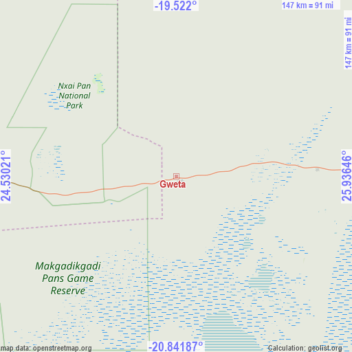
Gweta GPS coordinates[2]
20° 10' 59.988" South, 25° 13' 59.988" East
| Map corner | latitude | longitude |
|---|---|---|
| Upper-left | -19.522°, | 24.53021° |
| Center: | -20.18333°, | 25.23333° |
| Lower-right: | -20.84187°, | 25.93646° |
| Map W x H: | 146.8×146.8 km | = 91.2×91.2mi |
| max Lat: | -17.80165° ⇑8.6% North |
| Gweta: | -20.18333° |
| min Lat: | ⇓91.4% South -26.9° |
| min Long | Gweta | max Long |
| 20.06667° | 25.23333° | 28.74946° |
| W 29.5%⇐ | ⇒70.5% E |
Elevation
Elevation of Gweta is 929 m = 3048 ft, and this is 86 m = 282 ft below average elevation for this country.
| Max E: |
1406 m = 4613 ft | 77.1% |
| Avg. | 1015 m = 3330 ft | |
| Gweta | 929 m = 3048 ft | |
Min E: |
676 m = 2218 ft | 22.9% |
See also: Botswana elevation on elevation.city.
Geographical zone
Gweta is located in South Torrid zone (between Equator and Tropic of Capricorn). Distance of this Southern Tropic circle is 361.7 km =224.7 mi to South.| Distance of | km | miles | from Gweta |
|---|---|---|---|
| Equator | 2244.2 | 1394.5 | to North |
| Tropic Capricorn | 361.7 | 224.7 | to South |
| Antarctic Circle | 5157 | 3204.4 | to South |
| South Pole | 7762.9 | 4823.6 | to South |


Nearby cities:
15 places around Gweta: (largest is in red/bold)
• Dukwe
131.1 km =81.5 mi,  109°
109°
• Kalakamati
221.2 km =137.4 mi,  101°
101°
• Letlhakane
141.9 km =88.2 mi,  164°
164°
• Makaleng
227.8 km =141.5 mi, 110°
• Masunga
236 km =146.6 mi, 101°
• Mathambgwane
236.1 km =146.7 mi, 112°
• Maun
191 km =118.7 mi,  276°
276°
• Mopipi
117 km =72.7 mi,  198°
198°
• Mosetse
160.5 km =99.7 mi, 113°
• Nata
99.2 km =61.6 mi,  92°
92°
• Orapa
126.3 km =78.5 mi,  173°
173°
• Pandamatenga
188.7 km =117.3 mi,  12°
12°
• Rakops
130.2 km =80.9 mi,  224°
224°
• Sebina
223.3 km =138.8 mi, 109°
• Sua
102 km =63.4 mi,  81°
81°
Sources, notices
• [Note1] Compared only with cities in Botswana existing in our database
• [Src1] Map data: © OpenStreetMap contributors (CC-BY-SA)
• [Src2] Other city data from geonames.org with taken over terms of usage.
• [Src3] Geographical zone / Annual Mean Temperature by Robert A. Rohde @ Wikipedia
