Mokolo geodata
Mokolo (Far North) is a populated place; located in Cameroon in Africa/Douala (GMT+1) time zone. With population of 275,239 people, there are 7 cities with bigger population in this country. Compared to other cities in Cameroon, 96.7% of cities are located further ↓South; 83.6% of cities are located further ←West and 69.7% of cities have lower elevation than Mokolo. Note1


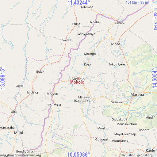
Mokolo GPS coordinates[2]
10° 44' 32.784" North, 13° 48' 8.172" East
| Map corner | latitude | longitude |
|---|---|---|
| Upper-left | 11.43244°, | 13.09915° |
| Center: | 10.74244°, | 13.80227° |
| Lower-right: | 10.05086°, | 14.5054° |
| Map W x H: | 153.6×153.6 km | = 95.4×95.4mi |
| max Lat: | 12.57535° ⇑3.3% North |
| Mokolo: | 10.74244° |
| min Lat: | ⇓96.7% South 2.35° |
| min Long | Mokolo | max Long |
| 8.8724° | 13.80227° | 15.23288° |
| W 83.6%⇐ | ⇒16.4% E |
Elevation
Elevation of Mokolo is 813 m = 2667 ft, and this is 139.1 m = 456 ft above average elevation for this country.
| Max E: |
1687 m = 5535 ft | 30.3% |
| Mokolo | 813 m 2667 ft | |
| Avg. | 673.9 m = 2211 ft | |
Min E: |
1 m = 3 ft | 69.7% |
See also: Mokolo elevation on elevation.city.
Geographical zone
Mokolo is located in North Torrid zone (between Equator and Tropic of Cancer). Distance of Equator is 1194.4 km =742.2 mi to South.| Distance of | km | miles | from Mokolo |
|---|---|---|---|
| North Pole | 8812.6 | 5475.9 | to North |
| Arctic Circle | 6206.7 | 3856.7 | to North |
| Tropic Cancer | 1411.5 | 877.1 | to North |
| Equator | 1194.4 | 742.2 | to South |


Nearby cities:
15 places around Mokolo: (largest is in red/bold)
• Bogo
88.2 km =54.8 mi,  90°
90°
• Garoua
166.2 km =103.3 mi,  195°
195°
• Guider
91.3 km =56.7 mi,  170°
170°
• Kaélé
99.9 km =62.1 mi,  134°
134°
• Kousséri
199.8 km =124.1 mi,  42°
42°
• Koza
16.5 km =10.3 mi,  31°
31°
• Lagdo
187.9 km =116.8 mi,  184°
184°
• Makary
215.8 km =134.1 mi,  19°
19°
• Maroua
58.6 km =36.4 mi,  106°
106°
• Mindif
79.2 km =49.2 mi,  118°
118°
• Mora
50 km =31.1 mi,  47°
47°
• Pitoa
154.6 km =96.1 mi,  192°
192°
• Poli
259.5 km =161.2 mi, 193°
• Rey Bouba
233.8 km =145.3 mi, 169°
• Yagoua
162.6 km =101 mi, 105°
Sources, notices
• [Note1] Compared only with cities in Cameroon existing in our database
• [Src1] Map data: © OpenStreetMap contributors (CC-BY-SA)
• [Src2] Other city data from geonames.org with taken over terms of usage.
• [Src3] Geographical zone / Annual Mean Temperature by Robert A. Rohde @ Wikipedia
