Bogo geodata
Bogo (Far North) is a populated place; located in Cameroon in Africa/Douala (GMT+1) time zone. With population of 16,952 people, there are 61 cities with bigger population in this country. Compared to other cities in Cameroon, 95.9% of cities are located further ↓South; 95.9% of cities are located further ←West and 75.4% of cities have higher elevation than Bogo. Note1


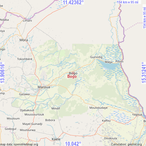
Bogo GPS coordinates[2]
10° 44' 0.96" North, 14° 36' 33.408" East
| Map corner | latitude | longitude |
|---|---|---|
| Upper-left | 11.42362°, | 13.90616° |
| Center: | 10.7336°, | 14.60928° |
| Lower-right: | 10.042°, | 15.31241° |
| Map W x H: | 153.6×153.6 km | = 95.4×95.4mi |
| max Lat: | 12.57535° ⇑4.1% North |
| Bogo: | 10.7336° |
| min Lat: | ⇓95.9% South 2.35° |
| min Long | Bogo | max Long |
| 8.8724° | 14.60928° | 15.23288° |
| W 95.9%⇐ | ⇒4.1% E |
Elevation
Elevation of Bogo is 343 m = 1125 ft, and this is 330.9 m = 1086 ft below average elevation for this country.
| Max E: |
1687 m = 5535 ft | 75.4% |
| Avg. | 673.9 m = 2211 ft | |
| Bogo | 343 m = 1125 ft | |
Min E: |
1 m = 3 ft | 24.6% |
See also: Cameroon elevation on elevation.city.
Geographical zone
Bogo is located in North Torrid zone (between Equator and Tropic of Cancer). Distance of Equator is 1193.5 km =741.6 mi to South.| Distance of | km | miles | from Bogo |
|---|---|---|---|
| North Pole | 8813.6 | 5476.5 | to North |
| Arctic Circle | 6207.7 | 3857.3 | to North |
| Tropic Cancer | 1412.5 | 877.7 | to North |
| Equator | 1193.5 | 741.6 | to South |


Nearby cities:
15 places around Bogo: (largest is in red/bold)
• Garoua
207.3 km =128.8 mi,  219°
219°
• Guider
114.8 km =71.3 mi, 219°
• Kaélé
71.6 km =44.5 mi,  194°
194°
• Kousséri
156.3 km =97.1 mi,  17°
17°
• Koza
80.8 km =50.2 mi,  280°
280°
• Lagdo
213 km =132.4 mi,  209°
209°
• Makary
205.5 km =127.7 mi,  355°
355°
• Maroua
35.8 km =22.2 mi,  243°
243°
• Mindif
41.9 km =26 mi, 206°
• Mokolo
88.2 km =54.8 mi,  270°
270°
• Mora
61.9 km =38.5 mi,  304°
304°
• Pitoa
192.9 km =119.9 mi, 218°
• Rey Bouba
234 km =145.4 mi, 191°
• Tcholliré
263.7 km =163.9 mi, 190°
• Yagoua
80.9 km =50.3 mi,  122°
122°
Sources, notices
• [Note1] Compared only with cities in Cameroon existing in our database
• [Src1] Map data: © OpenStreetMap contributors (CC-BY-SA)
• [Src2] Other city data from geonames.org with taken over terms of usage.
• [Src3] Geographical zone / Annual Mean Temperature by Robert A. Rohde @ Wikipedia
