Bertoua geodata
Bertoua (East) is a seat of a first-order administrative division; located in Cameroon in Africa/Douala (GMT+1) time zone. With population of 218,111 people, there are 9 cities with bigger population in this country. Compared to other cities in Cameroon, 61.5% of cities are located further ↑North; 82.8% of cities are located further ←West and 56.6% of cities have lower elevation than Bertoua. Note1


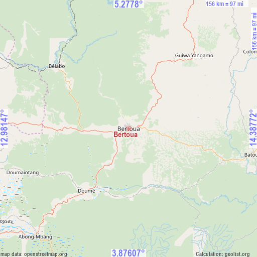
Bertoua GPS coordinates[2]
4° 34' 38.208" North, 13° 41' 4.524" East
| Map corner | latitude | longitude |
|---|---|---|
| Upper-left | 5.2778°, | 12.98147° |
| Center: | 4.57728°, | 13.68459° |
| Lower-right: | 3.87607°, | 14.38772° |
| Map W x H: | 155.9×155.9 km | = 96.9×96.9mi |
| max Lat: | 12.57535° ⇑61.5% North |
| Bertoua: | 4.57728° |
| min Lat: | ⇓38.5% South 2.35° |
| min Long | Bertoua | max Long |
| 8.8724° | 13.68459° | 15.23288° |
| W 82.8%⇐ | ⇒17.2% E |
Elevation
Elevation of Bertoua is 665 m = 2182 ft, and this is 8.9 m = 29 ft below average elevation for this country.
| Max E: |
1687 m = 5535 ft | 43.4% |
| Avg. | 673.9 m = 2211 ft | |
| Bertoua | 665 m = 2182 ft | |
Min E: |
1 m = 3 ft | 56.6% |
See also: Bertoua elevation on elevation.city.
Geographical zone
Bertoua is located in North Torrid zone (between Equator and Tropic of Cancer). Distance of Equator is 508.9 km =316.2 mi to South.| Distance of | km | miles | from Bertoua |
|---|---|---|---|
| North Pole | 9498.1 | 5901.8 | to North |
| Arctic Circle | 6892.2 | 4282.6 | to North |
| Tropic Cancer | 2097 | 1303 | to North |
| Equator | 508.9 | 316.2 | to South |


Nearby cities:
15 places around Bertoua: (largest is in red/bold)
• Abong Mbang
86.3 km =53.6 mi,  220°
220°
• Akonolinga
182.8 km =113.6 mi,  240°
240°
• Batouri
77.3 km =48 mi,  101°
101°
• Bélabo
58.2 km =36.2 mi,  312°
312°
• Bétaré Oya
122 km =75.8 mi,  21°
21°
• Dimako
25.2 km =15.7 mi,  211°
211°
• Doumé
46.2 km =28.7 mi, 214°
• Garoua Boulaï
174 km =108.1 mi,  33°
33°
• Mbang
38.9 km =24.2 mi,  270°
270°
• Minta
98 km =60.9 mi, 270°
• Nanga Eboko
146.5 km =91 mi, 274°
• Ndelele
149.9 km =93.1 mi,  113°
113°
• Nkoteng
183.1 km =113.8 mi, 267°
• Yokadouma
191.9 km =119.2 mi,  127°
127°
• Yoko
185.1 km =115 mi, 305°
Sources, notices
• [Note1] Compared only with cities in Cameroon existing in our database
• [Src1] Map data: © OpenStreetMap contributors (CC-BY-SA)
• [Src2] Other city data from geonames.org with taken over terms of usage.
• [Src3] Geographical zone / Annual Mean Temperature by Robert A. Rohde @ Wikipedia
