Ndelele geodata
Ndelele (East) is a populated place; located in Cameroon in Africa/Douala (GMT+1) time zone. With population of 5,040 people, there are 103 cities with bigger population in this country. Compared to other cities in Cameroon, 81.1% of cities are located further ↑North; 97.5% of cities are located further ←West and 52.5% of cities have higher elevation than Ndelele. Note1


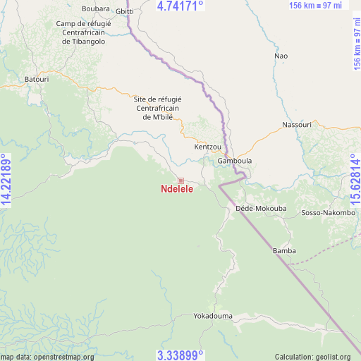
Ndelele GPS coordinates[2]
4° 2' 26.34" North, 14° 55' 30.036" East
| Map corner | latitude | longitude |
|---|---|---|
| Upper-left | 4.74171°, | 14.22189° |
| Center: | 4.04065°, | 14.92501° |
| Lower-right: | 3.33899°, | 15.62814° |
| Map W x H: | 156×156 km | = 96.9×96.9mi |
| max Lat: | 12.57535° ⇑81.1% North |
| Ndelele: | 4.04065° |
| min Lat: | ⇓18.9% South 2.35° |
| min Long | Ndelele | max Long |
| 8.8724° | 14.92501° | 15.23288° |
| W 97.5%⇐ | ⇒2.5% E |
Elevation
Elevation of Ndelele is 605 m = 1985 ft, and this is 68.9 m = 226 ft below average elevation for this country.
| Max E: |
1687 m = 5535 ft | 52.5% |
| Avg. | 673.9 m = 2211 ft | |
| Ndelele | 605 m = 1985 ft | |
Min E: |
1 m = 3 ft | 47.5% |
See also: Cameroon elevation on elevation.city.
Geographical zone
Ndelele is located in North Torrid zone (between Equator and Tropic of Cancer). Distance of Equator is 449.3 km =279.2 mi to South.| Distance of | km | miles | from Ndelele |
|---|---|---|---|
| North Pole | 9557.8 | 5938.9 | to North |
| Arctic Circle | 6951.9 | 4319.7 | to North |
| Tropic Cancer | 2156.6 | 1340 | to North |
| Equator | 449.3 | 279.2 | to South |


Nearby cities:
15 places around Ndelele: (largest is in red/bold)
• Abong Mbang
193.3 km =120.1 mi,  268°
268°
• Akonolinga
298.3 km =185.4 mi,  264°
264°
• Batouri
75.8 km =47.1 mi,  305°
305°
• Bertoua
149.9 km =93.1 mi,  293°
293°
• Bélabo
205.7 km =127.8 mi,  298°
298°
• Bétaré Oya
196.9 km =122.3 mi,  331°
331°
• Dimako
155.4 km =96.6 mi,  284°
284°
• Djohong
311.5 km =193.6 mi,  355°
355°
• Doumé
165 km =102.5 mi, 277°
• Garoua Boulaï
209.1 km =129.9 mi,  348°
348°
• Mbang
186.5 km =115.9 mi, 288°
• Meïganga
283.9 km =176.4 mi, 345°
• Minta
243.2 km =151.1 mi, 284°
• Nanga Eboko
292.5 km =181.8 mi, 284°
• Yokadouma
59.9 km =37.2 mi,  166°
166°
Sources, notices
• [Note1] Compared only with cities in Cameroon existing in our database
• [Src1] Map data: © OpenStreetMap contributors (CC-BY-SA)
• [Src2] Other city data from geonames.org with taken over terms of usage.
• [Src3] Geographical zone / Annual Mean Temperature by Robert A. Rohde @ Wikipedia
