Yanduo geodata
Yanduo (Tibet) is a seat of a third-order administrative division; located in China in Asia/Shanghai (GMT+8) time zone. In our database, there are 1268 cities with bigger population. Compared to other cities in China, 51.7% of cities are located further ↓South; 95.5% of cities are located further →East and 97.2% of cities have lower elevation than Yanduo. Note1


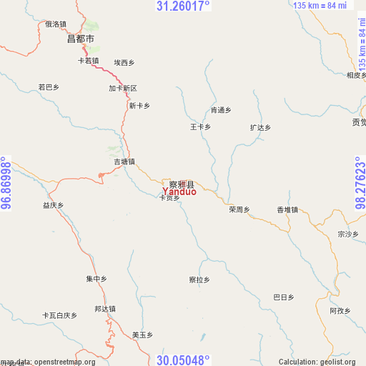
Yanduo GPS coordinates[2]
30° 39' 25.992" North, 97° 34' 23.16" East
| Map corner | latitude | longitude |
|---|---|---|
| Upper-left | 31.26017°, | 96.86998° |
| Center: | 30.65722°, | 97.5731° |
| Lower-right: | 30.05048°, | 98.27623° |
| Map W x H: | 134.5×134.5 km | = 83.6×83.6mi |
| max Lat: | 53.31946° ⇑48.3% North |
| Yanduo: | 30.65722° |
| min Lat: | ⇓51.7% South 18.22056° |
| min Long | Yanduo | max Long |
| 75.07348° | 97.5731° | 134.28917° |
| W 4.5%⇐ | ⇒95.5% E |
Elevation
Elevation of Yanduo is 3159 m = 10364 ft, and this is 2674.2 m = 8774 ft above average elevation for this country.
| Max E: |
5622 m = 18445 ft | 2.8% |
| Yanduo | 3159 m 10364 ft | |
| Avg. | 484.8 m = 1591 ft | |
Min E: |
-3 m = -10 ft | 97.2% |
See also: China elevation on elevation.city.
Geographical zone
Yanduo is located in North temperate zone (between Tropic of Cancer and the Arctic Circle). Distance of this Northern Tropic circle is 802.8 km =498.8 mi to South.| Distance of | km | miles | from Yanduo |
|---|---|---|---|
| North Pole | 6598.3 | 4100 | to North |
| Arctic Circle | 3992.4 | 2480.8 | to North |
| Tropic Cancer | 802.8 | 498.8 | to South |
| Equator | 3408.8 | 2118.1 | to South |


Nearby cities:
15 places around Yanduo: (largest is in red/bold)
• Baima
91.6 km =56.9 mi,  223°
223°
• Gartog
146.1 km =90.8 mi,  137°
137°
• Gengqing
161.5 km =100.4 mi,  37°
37°
• Jomda
111.4 km =69.2 mi,  33°
33°
• Molo
70.6 km =43.9 mi,  71°
71°
• Moluo
53 km =32.9 mi, 72°
• Mozhong
193 km =119.9 mi,  338°
338°
• Nyagla
168.9 km =104.9 mi, 335°
• Qamdo
64.6 km =40.1 mi,  324°
324°
• Qiezha
187 km =116.2 mi,  327°
327°
• Racaka
130.2 km =80.9 mi,  309°
309°
• Samdo
111.6 km =69.3 mi,  303°
303°
• Wangda
112.2 km =69.7 mi,  166°
166°
• Xiao Surmang
191 km =118.7 mi,  350°
350°
• Zito
166.3 km =103.3 mi,  273°
273°
Sources, notices
• [Note1] Compared only with cities in China existing in our database
• [Src1] Map data: © OpenStreetMap contributors (CC-BY-SA)
• [Src2] Other city data from geonames.org with taken over terms of usage.
• [Src3] Geographical zone / Annual Mean Temperature by Robert A. Rohde @ Wikipedia
