Saldaña geodata
Saldaña (Tolima) is a seat of a second-order administrative division; located in Colombia in America/Bogota (GMT-5) time zone. With population of 9,237 people, there are 329 cities with bigger population in this country. Compared to other cities in Colombia, 78.5% of cities are located further ↑North; 54.4% of cities are located further →East and 69% of cities have higher elevation than Saldaña. Note1


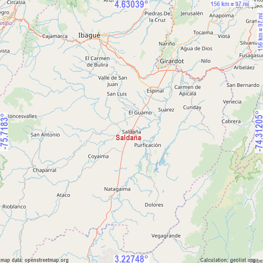
Saldaña GPS coordinates[2]
3° 55' 45.228" North, 75° 0' 54.612" West
| Map corner | latitude | longitude |
|---|---|---|
| Upper-left | 4.63039°, | -75.7183° |
| Center: | 3.92923°, | -75.01517° |
| Lower-right: | 3.22748°, | -74.31205° |
| Map W x H: | 156×156 km | = 96.9×96.9mi |
| max Lat: | 13.38166° ⇑78.5% North |
| Saldaña: | 3.92923° |
| min Lat: | ⇓21.5% South -4.21528° |
| min Long | Saldaña | max Long |
| -81.70636° | -75.01517° | -67.06996° |
| W 45.6%⇐ | ⇒54.4% E |
Elevation
Elevation of Saldaña is 311 m = 1020 ft, and this is 838.3 m = 2750 ft below average elevation for this country.
| Max E: |
3342 m = 10965 ft | 69% |
| Avg. | 1149.3 m = 3771 ft | |
| Saldaña | 311 m = 1020 ft | |
Min E: |
1 m = 3 ft | 31% |
See also: Colombia elevation on elevation.city.
Geographical zone
Saldaña is located in North Torrid zone (between Equator and Tropic of Cancer). Distance of Equator is 436.9 km =271.5 mi to South.| Distance of | km | miles | from Saldaña |
|---|---|---|---|
| North Pole | 9570.2 | 5946.6 | to North |
| Arctic Circle | 6964.3 | 4327.4 | to North |
| Tropic Cancer | 2169 | 1347.8 | to North |
| Equator | 436.9 | 271.5 | to South |


Nearby cities:
15 places around Saldaña: (largest is in red/bold)
• Carmen de Apicalá
40.7 km =25.3 mi,  53°
53°
• Chicoral
32 km =19.9 mi,  6°
6°
• Coyaima
24.6 km =15.3 mi,  234°
234°
• Cunday
38.7 km =24 mi,  67°
67°
• Espinal
28.4 km =17.6 mi,  30°
30°
• Guamo
12.3 km =7.6 mi,  23°
23°
• La Chamba
19.5 km =12.1 mi,  56°
56°
• Natagaima
35.4 km =22 mi,  194°
194°
• Ortega
22.9 km =14.2 mi,  271°
271°
• Prado
21.9 km =13.6 mi,  154°
154°
• Purificación
12.2 km =7.6 mi,  130°
130°
• San Luis
24.3 km =15.1 mi,  338°
338°
• Suárez
24.3 km =15.1 mi, 56°
• Tres Esquinas
34.7 km =21.6 mi,  101°
101°
• Valle de San Juan
32 km =19.9 mi, 339°
Sources, notices
• [Note1] Compared only with cities in Colombia existing in our database
• [Src1] Map data: © OpenStreetMap contributors (CC-BY-SA)
• [Src2] Other city data from geonames.org with taken over terms of usage.
• [Src3] Geographical zone / Annual Mean Temperature by Robert A. Rohde @ Wikipedia
