Bir el Ater geodata
Bir el Ater (Tébessa) is a populated place; located in Algeria in Africa/Algiers (GMT+1) time zone. With population of 68,703 people, there are 61 cities with bigger population in this country. Compared to other cities in Algeria, 83.7% of cities are located further ↑North; 98.4% of cities are located further ←West and 81.8% of cities have lower elevation than Bir el Ater. Note1


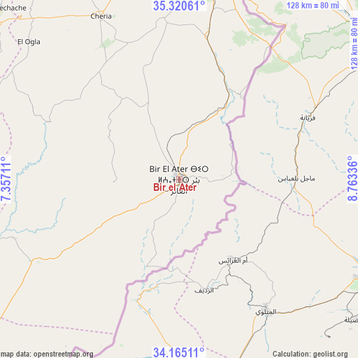
Bir el Ater GPS coordinates[2]
34° 44' 41.568" North, 8° 3' 36.864" East
| Map corner | latitude | longitude |
|---|---|---|
| Upper-left | 35.32061°, | 7.35711° |
| Center: | 34.74488°, | 8.06024° |
| Lower-right: | 34.16511°, | 8.76336° |
| Map W x H: | 128.5×128.5 km | = 79.8×79.8mi |
| max Lat: | 36.92917° ⇑83.7% North |
| Bir el Ater: | 34.74488° |
| min Lat: | ⇓16.3% South 22.785° |
| min Long | Bir el Ater | max Long |
| -8.14743° | 8.06024° | 8.46667° |
| W 98.4%⇐ | ⇒1.6% E |
Elevation
Elevation of Bir el Ater is 889 m = 2917 ft, and this is 450.5 m = 1478 ft above average elevation for this country.
| Max E: |
1392 m = 4567 ft | 18.2% |
| Bir el Ater | 889 m 2917 ft | |
| Avg. | 438.5 m = 1439 ft | |
Min E: |
5 m = 16 ft | 81.8% |
See also: Bir el Ater elevation on elevation.city.
Geographical zone
Bir el Ater is located in North temperate zone (between Tropic of Cancer and the Arctic Circle). Distance of this Northern Tropic circle is 1257.3 km =781.2 mi to South.| Distance of | km | miles | from Bir el Ater |
|---|---|---|---|
| North Pole | 6143.8 | 3817.6 | to North |
| Arctic Circle | 3537.9 | 2198.3 | to North |
| Tropic Cancer | 1257.3 | 781.2 | to South |
| Equator | 3863.3 | 2400.5 | to South |


Nearby cities:
15 places around Bir el Ater: (largest is in red/bold)
• Arris
166.2 km =103.3 mi,  290°
290°
• Aïn Beïda
131.7 km =81.8 mi,  332°
332°
• Aïn Fakroun
173.7 km =107.9 mi,  321°
321°
• Aïn Kercha
180.4 km =112.1 mi, 316°
• Cheria
65.1 km =40.5 mi, 334°
• Debila
170.6 km =106 mi,  216°
216°
• El Aouinet
125.7 km =78.1 mi,  352°
352°
• Hammamet
78.9 km =49 mi, 352°
• Khenchela
113.4 km =70.5 mi,  312°
312°
• Meskiana
104.8 km =65.1 mi,  340°
340°
• Oum el Bouaghi
152.2 km =94.6 mi, 325°
• Sedrata
161.1 km =100.1 mi, 342°
• Souk Ahras
171.7 km =106.7 mi,  356°
356°
• Tébessa
73.5 km =45.7 mi,  4°
4°
• Zeribet el Oued
141.8 km =88.1 mi,  267°
267°
Sources, notices
• [Note1] Compared only with cities in Algeria existing in our database
• [Src1] Map data: © OpenStreetMap contributors (CC-BY-SA)
• [Src2] Other city data from geonames.org with taken over terms of usage.
• [Src3] Geographical zone / Annual Mean Temperature by Robert A. Rohde @ Wikipedia
