Khenchela geodata
Khenchela is a seat of a first-order administrative division; located in Algeria in Africa/Algiers (GMT+1) time zone. With population of 117,000 people, there are 36 cities with bigger population in this country. Compared to other cities in Algeria, 68.6% of cities are located further ↑North; 91.9% of cities are located further ←West and 96.1% of cities have lower elevation than Khenchela. Note1


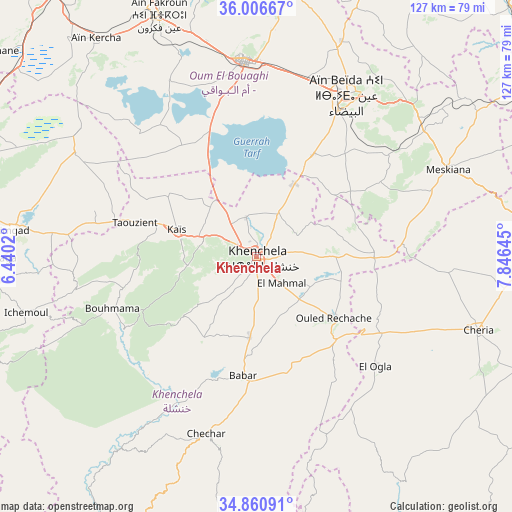
Khenchela GPS coordinates[2]
35° 26' 8.988" North, 7° 8' 35.988" East
| Map corner | latitude | longitude |
|---|---|---|
| Upper-left | 36.00667°, | 6.4402° |
| Center: | 35.43583°, | 7.14333° |
| Lower-right: | 34.86091°, | 7.84645° |
| Map W x H: | 127.4×127.4 km | = 79.2×79.2mi |
| max Lat: | 36.92917° ⇑68.6% North |
| Khenchela: | 35.43583° |
| min Lat: | ⇓31.4% South 22.785° |
| min Long | Khenchela | max Long |
| -8.14743° | 7.14333° | 8.46667° |
| W 91.9%⇐ | ⇒8.1% E |
Elevation
Elevation of Khenchela is 1128 m = 3701 ft, and this is 689.5 m = 2262 ft above average elevation for this country.
| Max E: |
1392 m = 4567 ft | 3.9% |
| Khenchela | 1128 m 3701 ft | |
| Avg. | 438.5 m = 1439 ft | |
Min E: |
5 m = 16 ft | 96.1% |
See also: Khenchela elevation on elevation.city.
Geographical zone
Khenchela is located in North temperate zone (between Tropic of Cancer and the Arctic Circle). Distance of this Northern Tropic circle is 1334.2 km =829 mi to South.| Distance of | km | miles | from Khenchela |
|---|---|---|---|
| North Pole | 6067 | 3769.9 | to North |
| Arctic Circle | 3461.1 | 2150.6 | to North |
| Tropic Cancer | 1334.2 | 829 | to South |
| Equator | 3940.1 | 2448.3 | to South |


Nearby cities:
15 places around Khenchela: (largest is in red/bold)
• Arris
74.9 km =46.5 mi,  254°
254°
• Aïn Beïda
46 km =28.6 mi,  29°
29°
• Aïn Fakroun
64.3 km =40 mi,  337°
337°
• Aïn Kercha
67.8 km =42.1 mi,  323°
323°
• Batna
88.7 km =55.1 mi,  278°
278°
• Cheria
58.1 km =36.1 mi,  108°
108°
• El Aouinet
82.5 km =51.3 mi,  54°
54°
• El Khroub
100.5 km =62.4 mi, 336°
• Hammamet
73.3 km =45.5 mi,  88°
88°
• Meskiana
52 km =32.3 mi,  65°
65°
• Oum el Bouaghi
49 km =30.4 mi,  356°
356°
• Sedrata
84.7 km =52.6 mi,  24°
24°
• Tazoult-Lambese
80.1 km =49.8 mi,  273°
273°
• Tébessa
88.9 km =55.2 mi, 92°
• ’Aïn Abid
90.3 km =56.1 mi,  348°
348°
Sources, notices
• [Note1] Compared only with cities in Algeria existing in our database
• [Src1] Map data: © OpenStreetMap contributors (CC-BY-SA)
• [Src2] Other city data from geonames.org with taken over terms of usage.
• [Src3] Geographical zone / Annual Mean Temperature by Robert A. Rohde @ Wikipedia
