Laghouat geodata
Laghouat is a seat of a first-order administrative division; located in Algeria in Africa/Algiers (GMT+1) time zone. With population of 113,872 people, there are 37 cities with bigger population in this country. Compared to other cities in Algeria, 88.4% of cities are located further ↑North; 63.2% of cities are located further →East and 73.6% of cities have lower elevation than Laghouat. Note1


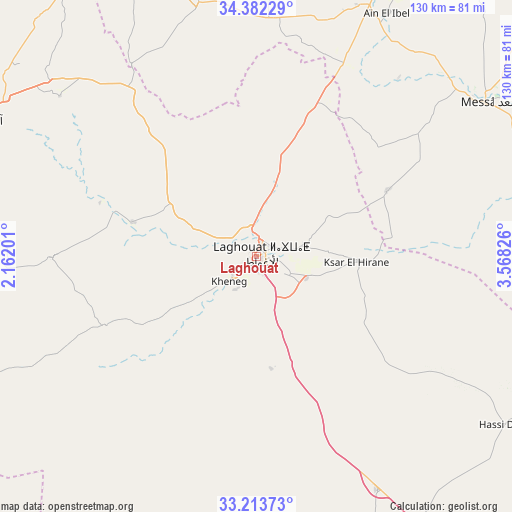
Laghouat GPS coordinates[2]
33° 48' 0" North, 2° 51' 54.504" East
| Map corner | latitude | longitude |
|---|---|---|
| Upper-left | 34.38229°, | 2.16201° |
| Center: | 33.8°, | 2.86514° |
| Lower-right: | 33.21373°, | 3.56826° |
| Map W x H: | 129.9×129.9 km | = 80.7×80.7mi |
| max Lat: | 36.92917° ⇑88.4% North |
| Laghouat: | 33.8° |
| min Lat: | ⇓11.6% South 22.785° |
| min Long | Laghouat | max Long |
| -8.14743° | 2.86514° | 8.46667° |
| W 36.8%⇐ | ⇒63.2% E |
Elevation
Elevation of Laghouat is 764 m = 2507 ft, and this is 325.5 m = 1068 ft above average elevation for this country.
| Max E: |
1392 m = 4567 ft | 26.4% |
| Laghouat | 764 m 2507 ft | |
| Avg. | 438.5 m = 1439 ft | |
Min E: |
5 m = 16 ft | 73.6% |
See also: Laghouat elevation on elevation.city.
Geographical zone
Laghouat is located in North temperate zone (between Tropic of Cancer and the Arctic Circle). Distance of this Northern Tropic circle is 1152.3 km =716 mi to South.| Distance of | km | miles | from Laghouat |
|---|---|---|---|
| North Pole | 6248.9 | 3882.9 | to North |
| Arctic Circle | 3643 | 2263.7 | to North |
| Tropic Cancer | 1152.3 | 716 | to South |
| Equator | 3758.2 | 2335.2 | to South |


Nearby cities:
15 places around Laghouat: (largest is in red/bold)
• Aflou
78.5 km =48.8 mi,  296°
296°
• Aïn Oussera
183.7 km =114.1 mi,  1°
1°
• Berriane
136.9 km =85.1 mi,  142°
142°
• Brezina
168 km =104.4 mi,  242°
242°
• Charef
91.5 km =56.9 mi,  355°
355°
• Dar Chioukh
134.5 km =83.6 mi,  25°
25°
• Djelfa
103.7 km =64.4 mi,  20°
20°
• El Bayadh
171.2 km =106.4 mi,  265°
265°
• El Idrissia
78.2 km =48.6 mi,  336°
336°
• Ghardaïa
163.9 km =101.8 mi,  152°
152°
• Ksar Chellala
164.8 km =102.4 mi, 342°
• Messaad
70.8 km =44 mi,  56°
56°
• ’Aïn Deheb
167.6 km =104.1 mi,  313°
313°
• ’Aïn el Bell
68.9 km =42.8 mi, 28°
• ’Aïn el Melh
166.2 km =103.3 mi,  45°
45°
Sources, notices
• [Note1] Compared only with cities in Algeria existing in our database
• [Src1] Map data: © OpenStreetMap contributors (CC-BY-SA)
• [Src2] Other city data from geonames.org with taken over terms of usage.
• [Src3] Geographical zone / Annual Mean Temperature by Robert A. Rohde @ Wikipedia
