’Aïn el Melh geodata
’Aïn el Melh (M'Sila) is a populated place; located in Algeria in Africa/Algiers (GMT+1) time zone. With population of 39,798 people, there are 130 cities with bigger population in this country. Compared to other cities in Algeria, 82.2% of cities are located further ↑North; 60.1% of cities are located further ←West and 85.7% of cities have lower elevation than ’Aïn el Melh. Note1


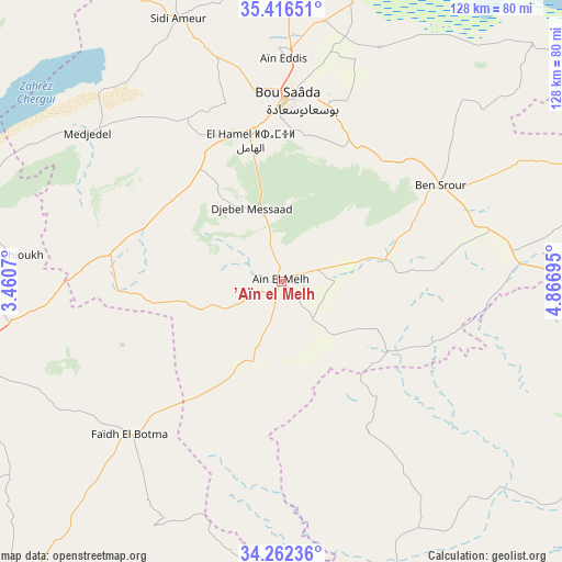
’Aïn el Melh GPS coordinates[2]
34° 50' 29.256" North, 4° 9' 49.788" East
| Map corner | latitude | longitude |
|---|---|---|
| Upper-left | 35.41651°, | 3.4607° |
| Center: | 34.84146°, | 4.16383° |
| Lower-right: | 34.26236°, | 4.86695° |
| Map W x H: | 128.3×128.3 km | = 79.7×79.7mi |
| max Lat: | 36.92917° ⇑82.2% North |
| ’Aïn el Melh: | 34.84146° |
| min Lat: | ⇓17.8% South 22.785° |
| min Long | ’Aïn el Melh | max Long |
| -8.14743° | 4.16383° | 8.46667° |
| W 60.1%⇐ | ⇒39.9% E |
Elevation
Elevation of ’Aïn el Melh is 930 m = 3051 ft, and this is 491.5 m = 1613 ft above average elevation for this country.
| Max E: |
1392 m = 4567 ft | 14.3% |
| ’Aïn el Melh | 930 m 3051 ft | |
| Avg. | 438.5 m = 1439 ft | |
Min E: |
5 m = 16 ft | 85.7% |
See also: Algeria elevation on elevation.city.
Geographical zone
’Aïn el Melh is located in North temperate zone (between Tropic of Cancer and the Arctic Circle). Distance of this Northern Tropic circle is 1268.1 km =788 mi to South.| Distance of | km | miles | from ’Aïn el Melh |
|---|---|---|---|
| North Pole | 6133.1 | 3810.9 | to North |
| Arctic Circle | 3527.2 | 2191.7 | to North |
| Tropic Cancer | 1268.1 | 788 | to South |
| Equator | 3874 | 2407.2 | to South |


Nearby cities:
15 places around ’Aïn el Melh: (largest is in red/bold)
• Aïn Oussera
133 km =82.6 mi,  300°
300°
• Barika
125.1 km =77.7 mi,  60°
60°
• Birine
122.7 km =76.2 mi,  315°
315°
• Bordj Ghdir
135.3 km =84.1 mi,  29°
29°
• Charef
127.5 km =79.2 mi,  258°
258°
• Dar Chioukh
62.2 km =38.6 mi,  275°
275°
• Djelfa
84.4 km =52.4 mi, 257°
• Melouza
126.6 km =78.7 mi,  0°
0°
• Messaad
97.5 km =60.6 mi,  218°
218°
• M’Sila
102.1 km =63.4 mi,  19°
19°
• Sidi Aïssa
121.4 km =75.4 mi,  342°
342°
• Sidi Khaled
90.8 km =56.4 mi,  123°
123°
• Tolga
111.7 km =69.4 mi,  96°
96°
• ‘Aïn el Hadjel
95.6 km =59.4 mi, 344°
• ’Aïn el Bell
102.2 km =63.5 mi,  237°
237°
Sources, notices
• [Note1] Compared only with cities in Algeria existing in our database
• [Src1] Map data: © OpenStreetMap contributors (CC-BY-SA)
• [Src2] Other city data from geonames.org with taken over terms of usage.
• [Src3] Geographical zone / Annual Mean Temperature by Robert A. Rohde @ Wikipedia
