Barika geodata
Barika (Batna) is a populated place; located in Algeria in Africa/Algiers (GMT+1) time zone. With population of 98,846 people, there are 43 cities with bigger population in this country. Compared to other cities in Algeria, 70.5% of cities are located further ↑North; 73.6% of cities are located further ←West and 58.1% of cities have lower elevation than Barika. Note1


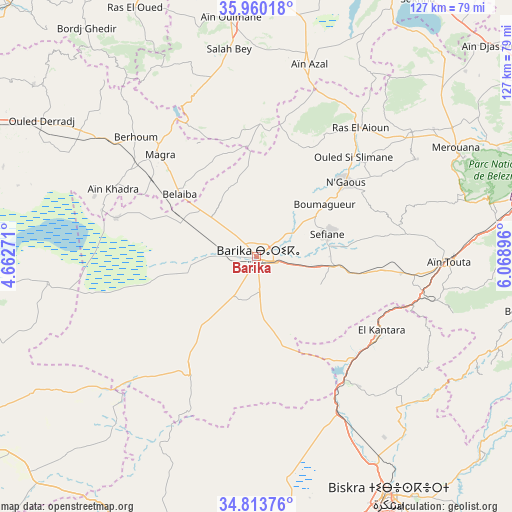
Barika GPS coordinates[2]
35° 23' 20.436" North, 5° 21' 57.024" East
| Map corner | latitude | longitude |
|---|---|---|
| Upper-left | 35.96018°, | 4.66271° |
| Center: | 35.38901°, | 5.36584° |
| Lower-right: | 34.81376°, | 6.06896° |
| Map W x H: | 127.5×127.5 km | = 79.2×79.2mi |
| max Lat: | 36.92917° ⇑70.5% North |
| Barika: | 35.38901° |
| min Lat: | ⇓29.5% South 22.785° |
| min Long | Barika | max Long |
| -8.14743° | 5.36584° | 8.46667° |
| W 73.6%⇐ | ⇒26.4% E |
Elevation
Elevation of Barika is 476 m = 1562 ft, and this is 37.5 m = 123 ft above average elevation for this country.
| Max E: |
1392 m = 4567 ft | 41.9% |
| Barika | 476 m 1562 ft | |
| Avg. | 438.5 m = 1439 ft | |
Min E: |
5 m = 16 ft | 58.1% |
See also: Barika elevation on elevation.city.
Geographical zone
Barika is located in North temperate zone (between Tropic of Cancer and the Arctic Circle). Distance of this Northern Tropic circle is 1329 km =825.8 mi to South.| Distance of | km | miles | from Barika |
|---|---|---|---|
| North Pole | 6072.2 | 3773.1 | to North |
| Arctic Circle | 3466.3 | 2153.9 | to North |
| Tropic Cancer | 1329 | 825.8 | to South |
| Equator | 3934.9 | 2445 | to South |


Nearby cities:
15 places around Barika: (largest is in red/bold)
• Aïn Arnat
88.8 km =55.2 mi,  356°
356°
• Aïn Touta
48.4 km =30.1 mi,  91°
91°
• Batna
75.5 km =46.9 mi,  75°
75°
• Biskra
68.4 km =42.5 mi,  151°
151°
• Bordj Ghdir
70.9 km =44.1 mi,  323°
323°
• Boumagueur
21.3 km =13.2 mi,  52°
52°
• Merouana
56.3 km =35 mi,  61°
61°
• M’Sila
82.4 km =51.2 mi,  295°
295°
• Oumache
82.5 km =51.3 mi,  159°
159°
• Râs el Aïoun
40.5 km =25.2 mi,  38°
38°
• Râs el Oued
68.7 km =42.7 mi,  333°
333°
• Salah Bey
52.2 km =32.4 mi,  352°
352°
• Sidi Okba
86.5 km =53.7 mi, 145°
• Tazoult-Lambese
81.7 km =50.8 mi, 82°
• Tolga
74.1 km =46 mi,  179°
179°
Sources, notices
• [Note1] Compared only with cities in Algeria existing in our database
• [Src1] Map data: © OpenStreetMap contributors (CC-BY-SA)
• [Src2] Other city data from geonames.org with taken over terms of usage.
• [Src3] Geographical zone / Annual Mean Temperature by Robert A. Rohde @ Wikipedia
