Huruta geodata
Huruta (Oromiya) is a populated place; located in Ethiopia in Africa/Addis_Ababa (GMT+3) time zone. With population of 12,442 people, there are 82 cities with bigger population in this country. Compared to other cities in Ethiopia, 65.4% of cities are located further ↑North; 72% of cities are located further ←West and 60.7% of cities have lower elevation than Huruta. Note1


Huruta GPS coordinates[2]
8° 9' 0" North, 39° 21' 0" East
| Map corner | latitude | longitude |
|---|---|---|
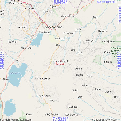
| Upper-left | 8.8454°, | 38.64688° |
| Center: | 8.15°, | 39.35° |
| Lower-right: | 7.45339°, | 40.05313° |
| Map W x H: | 154.8×154.8 km | = 96.2×96.2mi |
| max Lat: | 14.277° ⇑65.4% North |
| Huruta: | 8.15° |
| min Lat: | ⇓34.6% South 4.05° |
| min Long | Huruta | max Long |
| 34.53333° | 39.35° | 42.8° |
| W 72%⇐ | ⇒28% E |
Elevation
Elevation of Huruta is 2030 m = 6660 ft, and this is 134.4 m = 441 ft above average elevation for this country.
| Max E: |
2854 m = 9364 ft | 39.3% |
| Huruta | 2030 m 6660 ft | |
| Avg. | 1895.6 m = 6219 ft | |
Min E: |
367 m = 1204 ft | 60.7% |
See also: Ethiopia elevation on elevation.city.
Geographical zone
Huruta is located in North Torrid zone (between Equator and Tropic of Cancer). Distance of Equator is 906.2 km =563.1 mi to South.| Distance of | km | miles | from Huruta |
|---|---|---|---|
| North Pole | 9100.9 | 5655 | to North |
| Arctic Circle | 6495 | 4035.8 | to North |
| Tropic Cancer | 1699.7 | 1056.1 | to North |
| Equator | 906.2 | 563.1 | to South |


Nearby cities:
15 places around Huruta: (largest is in red/bold)
• Addis Ababa
117.7 km =73.1 mi,  325°
325°
• Bishoftu
78.4 km =48.7 mi, 328°
• Butajīra
108.3 km =67.3 mi,  268°
268°
• Dodola
131 km =81.4 mi,  188°
188°
• Metahāra
104.1 km =64.7 mi,  36°
36°
• Mojo
54.7 km =34 mi, 332°
• Nazrēt
45.4 km =28.2 mi,  348°
348°
• Sebeta
117.3 km =72.9 mi,  316°
316°
• Sendafa
117.1 km =72.8 mi,  342°
342°
• Shashemenē
134.1 km =83.3 mi,  218°
218°
• Sirre
23.6 km =14.7 mi, 38°
• Wenjī
34.2 km =21.3 mi, 347°
• Ziway
73.8 km =45.9 mi,  250°
250°
• Āsasa
117.9 km =73.3 mi, 188°
• Āwash
129 km =80.2 mi, 44°
Sources, notices
• [Note1] Compared only with cities in Ethiopia existing in our database
• [Src1] Map data: © OpenStreetMap contributors (CC-BY-SA)
• [Src2] Other city data from geonames.org with taken over terms of usage.
• [Src3] Geographical zone / Annual Mean Temperature by Robert A. Rohde @ Wikipedia
