Āwash geodata
Āwash (Āfar) is a populated place; located in Ethiopia in Africa/Addis_Ababa (GMT+3) time zone. With population of 11,415 people, there are 86 cities with bigger population in this country. Compared to other cities in Ethiopia, 50.5% of cities are located further ↓South; 87.9% of cities are located further ←West and 94.4% of cities have higher elevation than Āwash. Note1


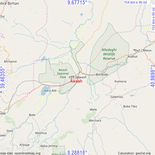
Āwash GPS coordinates[2]
8° 58' 59.988" North, 40° 10' 0.012" East
| Map corner | latitude | longitude |
|---|---|---|
| Upper-left | 9.67715°, | 39.46355° |
| Center: | 8.98333°, | 40.16667° |
| Lower-right: | 8.28818°, | 40.8698° |
| Map W x H: | 154.4×154.4 km | = 95.9×95.9mi |
| max Lat: | 14.277° ⇑49.5% North |
| Āwash: | 8.98333° |
| min Lat: | ⇓50.5% South 4.05° |
| min Long | Āwash | max Long |
| 34.53333° | 40.16667° | 42.8° |
| W 87.9%⇐ | ⇒12.1% E |
Elevation
Elevation of Āwash is 917 m = 3009 ft, and this is 978.6 m = 3211 ft below average elevation for this country.
| Max E: |
2854 m = 9364 ft | 94.4% |
| Avg. | 1895.6 m = 6219 ft | |
| Āwash | 917 m = 3009 ft | |
Min E: |
367 m = 1204 ft | 5.6% |
See also: Ethiopia elevation on elevation.city.
Geographical zone
Āwash is located in North Torrid zone (between Equator and Tropic of Cancer). Distance of Equator is 998.9 km =620.7 mi to South.| Distance of | km | miles | from Āwash |
|---|---|---|---|
| North Pole | 9008.2 | 5597.4 | to North |
| Arctic Circle | 6402.3 | 3978.2 | to North |
| Tropic Cancer | 1607.1 | 998.6 | to North |
| Equator | 998.9 | 620.7 | to South |


Nearby cities:
15 places around Āwash: (largest is in red/bold)
• Abomsa
113 km =70.2 mi,  349°
349°
• Bedēsa
68.4 km =42.5 mi,  97°
97°
• Bishoftu
133 km =82.6 mi,  258°
258°
• Debre Birhan
104.1 km =64.7 mi,  318°
318°
• Debre Sīna
105.9 km =65.8 mi,  335°
335°
• Gelemso
42.7 km =26.5 mi,  115°
115°
• Huruta
129 km =80.2 mi,  224°
224°
• Hīrna
105.7 km =65.7 mi,  75°
75°
• Metahāra
29 km =18 mi,  251°
251°
• Mojo
123.1 km =76.5 mi, 249°
• Nazrēt
110 km =68.4 mi,  244°
244°
• Sendafa
126.9 km =78.9 mi,  278°
278°
• Sirre
105.5 km =65.6 mi,  225°
225°
• Wenjī
113.8 km =70.7 mi, 238°
• Āsbe Teferī
77.7 km =48.3 mi, 81°
Sources, notices
• [Note1] Compared only with cities in Ethiopia existing in our database
• [Src1] Map data: © OpenStreetMap contributors (CC-BY-SA)
• [Src2] Other city data from geonames.org with taken over terms of usage.
• [Src3] Geographical zone / Annual Mean Temperature by Robert A. Rohde @ Wikipedia
