Tonate geodata
Tonate (Guyane) is a seat of a fourth-order administrative division; located in French Guiana in America/Cayenne (GMT-3) time zone. In our database, there are 14 cities with bigger population. Compared to other cities in French Guiana, 64.7% of cities are located further ↓South; 52.9% of cities are located further →East and 76.5% of cities have higher elevation than Tonate. Note1
Administrative division(s):
- Level 1: Guyane
- Level 2: Guyane
- Level 3: Arrondissement de Cayenne
- Level 4: Macouria


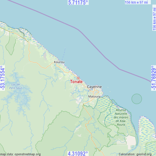
Tonate GPS coordinates[2]
5° 0' 42.156" North, 52° 28' 20.676" West
| Map corner | latitude | longitude |
|---|---|---|
| Upper-left | 5.71175°, | -53.17554° |
| Center: | 5.01171°, | -52.47241° |
| Lower-right: | 4.31092°, | -51.76929° |
| Map W x H: | 155.8×155.8 km | = 96.8×96.8mi |
| max Lat: | 5.66906° ⇑35.3% North |
| Tonate: | 5.01171° |
| min Lat: | ⇓64.7% South 3.16887° |
| min Long | Tonate | max Long |
| -54.38146° | -52.47241° | -51.80243° |
| W 47.1%⇐ | ⇒52.9% E |
Elevation
Elevation of Tonate is 7 m = 23 ft, and this is 16.9 m = 55 ft below average elevation for this country.
| Max E: |
106 m = 348 ft | 76.5% |
| Avg. | 23.9 m = 78 ft | |
| Tonate | 7 m = 23 ft | |
Min E: |
1 m = 3 ft | 23.5% |
See also: French Guiana elevation on elevation.city.
Geographical zone
Tonate is located in North Torrid zone (between Equator and Tropic of Cancer). Distance of Equator is 557.2 km =346.2 mi to South.| Distance of | km | miles | from Tonate |
|---|---|---|---|
| North Pole | 9449.8 | 5871.8 | to North |
| Arctic Circle | 6843.9 | 4252.6 | to North |
| Tropic Cancer | 2048.7 | 1273 | to North |
| Equator | 557.2 | 346.2 | to South |


Nearby cities:
15 places around Tonate: (largest is in red/bold)
• Apatou
207.8 km =129.1 mi,  274°
274°
• Camopi
205.5 km =127.7 mi,  175°
175°
• Cayenne
17.7 km =11 mi,  119°
119°
• Iracoubo
96.4 km =59.9 mi,  302°
302°
• Kourou
25.3 km =15.7 mi,  311°
311°
• Macouria
15.5 km =9.6 mi,  135°
135°
• Mana
162.1 km =100.7 mi, 296°
• Matoury
24.5 km =15.2 mi, 137°
• Roura
35.5 km =22.1 mi,  152°
152°
• Régina
86.4 km =53.7 mi, 154°
• Rémire
25.6 km =15.9 mi, 123°
• Rémire-Montjoly
25.1 km =15.6 mi,  114°
114°
• Saint-Georges
145.3 km =90.3 mi, 149°
• Saint-Laurent-du-Maroni
180.8 km =112.3 mi,  287°
287°
• Sinnamary
67.3 km =41.8 mi, 307°
Sources, notices
• [Note1] Compared only with cities in French Guiana existing in our database
• [Src1] Map data: © OpenStreetMap contributors (CC-BY-SA)
• [Src2] Other city data from geonames.org with taken over terms of usage.
• [Src3] Geographical zone / Annual Mean Temperature by Robert A. Rohde @ Wikipedia
