Camopi geodata
Camopi (Guyane) is a populated place; located in French Guiana in America/Cayenne (GMT-3) time zone. With population of 1,295 people, there are 13 cities with bigger population in this country. Compared to other cities in French Guiana, 100% of cities are located further ↑North; 58.8% of cities are located further ←West and 88.2% of cities have lower elevation than Camopi. Note1
Administrative division(s):
- Level 1: Guyane
- Level 2: Guyane
- Level 3: Arrondissement de Cayenne
- Level 4: Camopi


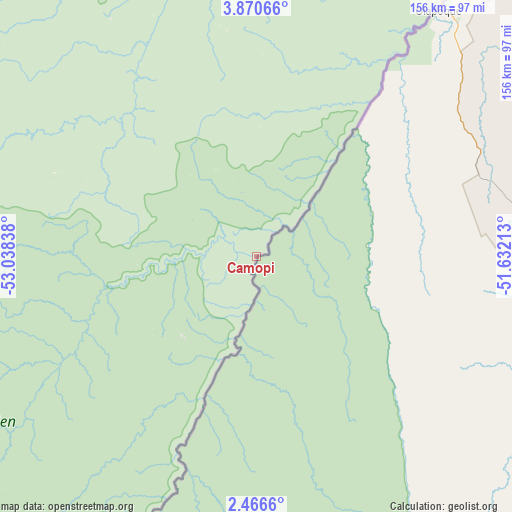
Camopi GPS coordinates[2]
3° 10' 7.932" North, 52° 20' 6.9" West
| Map corner | latitude | longitude |
|---|---|---|
| Upper-left | 3.87066°, | -53.03838° |
| Center: | 3.16887°, | -52.33525° |
| Lower-right: | 2.4666°, | -51.63213° |
| Map W x H: | 156.1×156.1 km | = 97×97mi |
| max Lat: | 5.66906° ⇑100% North |
| Camopi: | 3.16887° |
| min Lat: | ⇓0% South 3.16887° |
| min Long | Camopi | max Long |
| -54.38146° | -52.33525° | -51.80243° |
| W 58.8%⇐ | ⇒41.2% E |
Elevation
Elevation of Camopi is 62 m = 203 ft, and this is 38.1 m = 125 ft above average elevation for this country.
| Max E: |
106 m = 348 ft | 11.8% |
| Camopi | 62 m 203 ft | |
| Avg. | 23.9 m = 78 ft | |
Min E: |
1 m = 3 ft | 88.2% |
See also: French Guiana elevation on elevation.city.
Geographical zone
Camopi is located in North Torrid zone (between Equator and Tropic of Cancer). Distance of Equator is 352.3 km =218.9 mi to South.| Distance of | km | miles | from Camopi |
|---|---|---|---|
| North Pole | 9654.7 | 5999.2 | to North |
| Arctic Circle | 7048.8 | 4379.9 | to North |
| Tropic Cancer | 2253.6 | 1400.3 | to North |
| Equator | 352.3 | 218.9 | to South |


Nearby cities:
15 places around Camopi: (largest is in red/bold)
• Apatou
313.6 km =194.9 mi,  314°
314°
• Cayenne
196.2 km =121.9 mi,  0°
0°
• Grand-Santi
258.1 km =160.4 mi,  298°
298°
• Iracoubo
274.4 km =170.5 mi,  339°
339°
• Kourou
224.3 km =139.4 mi,  351°
351°
• Macouria
193.9 km =120.5 mi,  358°
358°
• Maripasoula
195.5 km =121.5 mi,  285°
285°
• Matoury
186.8 km =116.1 mi, 0°
• Roura
173.4 km =107.7 mi, 0°
• Régina
129.2 km =80.3 mi,  10°
10°
• Rémire
191 km =118.7 mi, 1°
• Rémire-Montjoly
194.5 km =120.9 mi, 2°
• Saint-Georges
99.5 km =61.8 mi,  36°
36°
• Sinnamary
255 km =158.4 mi, 344°
• Tonate
205.5 km =127.7 mi, 355°
Sources, notices
• [Note1] Compared only with cities in French Guiana existing in our database
• [Src1] Map data: © OpenStreetMap contributors (CC-BY-SA)
• [Src2] Other city data from geonames.org with taken over terms of usage.
• [Src3] Geographical zone / Annual Mean Temperature by Robert A. Rohde @ Wikipedia
