Saint-Georges geodata
Saint-Georges (Guyane) is a seat of a third-order administrative division; located in French Guiana in America/Cayenne (GMT-3) time zone. With population of 2,742 people, there are 10 cities with bigger population in this country. Compared to other cities in French Guiana, 88.2% of cities are located further ↑North; 100% of cities are located further ←West and 52.9% of cities have higher elevation than Saint-Georges. Note1
Administrative division(s):
- Level 1: Guyane
- Level 2: Guyane
- Level 3: Arrondissement de Cayenne
- Level 4: Saint-Georges


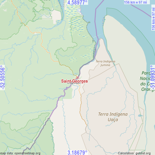
Saint-Georges GPS coordinates[2]
3° 53' 18.852" North, 51° 48' 8.748" West
| Map corner | latitude | longitude |
|---|---|---|
| Upper-left | 4.58977°, | -52.50556° |
| Center: | 3.88857°, | -51.80243° |
| Lower-right: | 3.18679°, | -51.09931° |
| Map W x H: | 156×156 km | = 96.9×96.9mi |
| max Lat: | 5.66906° ⇑88.2% North |
| Saint-Georges: | 3.88857° |
| min Lat: | ⇓11.8% South 3.16887° |
| min Long | Saint-Georges | max Long |
| -54.38146° | -51.80243° | -51.80243° |
| W 100%⇐ | ⇒0% E |
Elevation
Elevation of Saint-Georges is 8 m = 26 ft, and this is 15.9 m = 52 ft below average elevation for this country.
| Max E: |
106 m = 348 ft | 52.9% |
| Avg. | 23.9 m = 78 ft | |
| Saint-Georges | 8 m = 26 ft | |
Min E: |
1 m = 3 ft | 47.1% |
See also: French Guiana elevation on elevation.city.
Geographical zone
Saint-Georges is located in North Torrid zone (between Equator and Tropic of Cancer). Distance of Equator is 432.4 km =268.7 mi to South.| Distance of | km | miles | from Saint-Georges |
|---|---|---|---|
| North Pole | 9574.7 | 5949.4 | to North |
| Arctic Circle | 6968.8 | 4330.2 | to North |
| Tropic Cancer | 2173.6 | 1350.6 | to North |
| Equator | 432.4 | 268.7 | to South |


Nearby cities:
15 places around Saint-Georges: (largest is in red/bold)
• Camopi
99.5 km =61.8 mi,  216°
216°
• Cayenne
130.2 km =80.9 mi,  333°
333°
• Grand-Santi
289.2 km =179.7 mi,  278°
278°
• Iracoubo
235.5 km =146.3 mi,  318°
318°
• Kourou
169.5 km =105.3 mi, 326°
• Macouria
130.3 km =81 mi, 330°
• Mana
295.2 km =183.4 mi,  312°
312°
• Maripasoula
248.9 km =154.7 mi,  263°
263°
• Matoury
121.4 km =75.4 mi, 331°
• Roura
109.9 km =68.3 mi, 328°
• Régina
59.6 km =37 mi, 322°
• Rémire
122.8 km =76.3 mi, 334°
• Rémire-Montjoly
125.4 km =77.9 mi,  335°
335°
• Sinnamary
209.2 km =130 mi, 322°
• Tonate
145.3 km =90.3 mi, 329°
In other languages:
- In Spanish: Saint-Georges-de-l'Oyapock, San Jorge de Oyapoque
- In France: Saint-Georges, Saint-Georges-de-l'Oyapock
- In Russian: Сен-Жорж, Сен-Жорж-де-Луапок
Sources, notices
• [Note1] Compared only with cities in French Guiana existing in our database
• [Src1] Map data: © OpenStreetMap contributors (CC-BY-SA)
• [Src2] Other city data from geonames.org with taken over terms of usage.
• [Src3] Geographical zone / Annual Mean Temperature by Robert A. Rohde @ Wikipedia
