Kourou geodata
Kourou (Guyane) is a seat of a third-order administrative division; located in French Guiana in America/Cayenne (GMT-3) time zone. With population of 24,029 people, there are 3 cities with bigger population in this country. Compared to other cities in French Guiana, 76.5% of cities are located further ↓South; 58.8% of cities are located further →East and 76.5% of cities have higher elevation than Kourou. Note1
Administrative division(s):
- Level 1: Guyane
- Level 2: Guyane
- Level 3: Arrondissement de Cayenne
- Level 4: Kourou


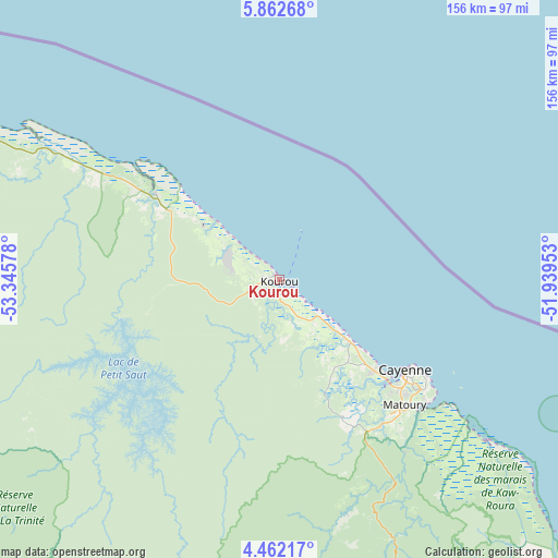
Kourou GPS coordinates[2]
5° 9' 46.116" North, 52° 38' 33.54" West
| Map corner | latitude | longitude |
|---|---|---|
| Upper-left | 5.86268°, | -53.34578° |
| Center: | 5.16281°, | -52.64265° |
| Lower-right: | 4.46217°, | -51.93953° |
| Map W x H: | 155.7×155.7 km | = 96.7×96.7mi |
| max Lat: | 5.66906° ⇑23.5% North |
| Kourou: | 5.16281° |
| min Lat: | ⇓76.5% South 3.16887° |
| min Long | Kourou | max Long |
| -54.38146° | -52.64265° | -51.80243° |
| W 41.2%⇐ | ⇒58.8% E |
Elevation
Elevation of Kourou is 7 m = 23 ft, and this is 16.9 m = 55 ft below average elevation for this country.
| Max E: |
106 m = 348 ft | 76.5% |
| Avg. | 23.9 m = 78 ft | |
| Kourou | 7 m = 23 ft | |
Min E: |
1 m = 3 ft | 23.5% |
See also: French Guiana elevation on elevation.city.
Geographical zone
Kourou is located in North Torrid zone (between Equator and Tropic of Cancer). Distance of Equator is 574.1 km =356.7 mi to South.| Distance of | km | miles | from Kourou |
|---|---|---|---|
| North Pole | 9433 | 5861.4 | to North |
| Arctic Circle | 6827.1 | 4242.2 | to North |
| Tropic Cancer | 2031.9 | 1262.6 | to North |
| Equator | 574.1 | 356.7 | to South |


Nearby cities:
15 places around Kourou: (largest is in red/bold)
• Apatou
188.3 km =117 mi,  269°
269°
• Cayenne
42.7 km =26.5 mi,  126°
126°
• Grand-Santi
216.6 km =134.6 mi,  242°
242°
• Iracoubo
71.6 km =44.5 mi,  299°
299°
• Macouria
40.7 km =25.3 mi, 133°
• Mana
137.8 km =85.6 mi,  294°
294°
• Matoury
49.7 km =30.9 mi, 134°
• Roura
59.7 km =37.1 mi,  143°
143°
• Régina
110.2 km =68.5 mi,  149°
149°
• Rémire
50.7 km =31.5 mi, 127°
• Rémire-Montjoly
49.8 km =30.9 mi,  123°
123°
• Saint-Georges
169.5 km =105.3 mi, 146°
• Saint-Laurent-du-Maroni
158.1 km =98.2 mi,  283°
283°
• Sinnamary
42.1 km =26.2 mi, 304°
• Tonate
25.3 km =15.7 mi, 131°
Sources, notices
• [Note1] Compared only with cities in French Guiana existing in our database
• [Src1] Map data: © OpenStreetMap contributors (CC-BY-SA)
• [Src2] Other city data from geonames.org with taken over terms of usage.
• [Src3] Geographical zone / Annual Mean Temperature by Robert A. Rohde @ Wikipedia
