Rémire-Montjoly geodata
Rémire-Montjoly (Guyane) is a populated place; located in French Guiana in America/Cayenne (GMT-3) time zone. With population of 19,029 people, there are 4 cities with bigger population in this country. Compared to other cities in French Guiana, 52.9% of cities are located further ↓South; 88.2% of cities are located further ←West and 76.5% of cities have higher elevation than Rémire-Montjoly. Note1
Administrative division(s):
- Level 1: Guyane
- Level 2: Guyane
- Level 3: Arrondissement de Cayenne
- Level 4: Remire-Montjoly


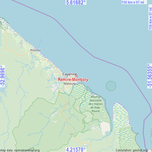
Rémire-Montjoly GPS coordinates[2]
4° 55' 0.012" North, 52° 16' 0.012" West
| Map corner | latitude | longitude |
|---|---|---|
| Upper-left | 5.61682°, | -52.9698° |
| Center: | 4.91667°, | -52.26667° |
| Lower-right: | 4.21578°, | -51.56355° |
| Map W x H: | 155.8×155.8 km | = 96.8×96.8mi |
| max Lat: | 5.66906° ⇑47.1% North |
| Rémire-Montjoly: | 4.91667° |
| min Lat: | ⇓52.9% South 3.16887° |
| min Long | Rémire-Montjol | max Long |
| -54.38146° | -52.26667° | -51.80243° |
| W 88.2%⇐ | ⇒11.8% E |
Elevation
Elevation of Rémire-Montjoly is 7 m = 23 ft, and this is 16.9 m = 55 ft below average elevation for this country.
| Max E: |
106 m = 348 ft | 76.5% |
| Avg. | 23.9 m = 78 ft | |
| Rémire-Montjoly | 7 m = 23 ft | |
Min E: |
1 m = 3 ft | 23.5% |
See also: French Guiana elevation on elevation.city.
Geographical zone
Rémire-Montjoly is located in North Torrid zone (between Equator and Tropic of Cancer). Distance of Equator is 546.7 km =339.7 mi to South.| Distance of | km | miles | from Rémire-Montjoly |
|---|---|---|---|
| North Pole | 9460.4 | 5878.4 | to North |
| Arctic Circle | 6854.5 | 4259.2 | to North |
| Tropic Cancer | 2059.2 | 1279.5 | to North |
| Equator | 546.7 | 339.7 | to South |


Nearby cities:
15 places around Rémire-Montjoly: (largest is in red/bold)
• Apatou
231.5 km =143.8 mi,  276°
276°
• Camopi
194.5 km =120.9 mi,  182°
182°
• Cayenne
7.6 km =4.7 mi, 284°
• Iracoubo
121.3 km =75.4 mi,  301°
301°
• Kourou
49.8 km =30.9 mi, 303°
• Macouria
11.9 km =7.4 mi,  267°
267°
• Mana
187.2 km =116.3 mi, 296°
• Matoury
9.8 km =6.1 mi,  220°
220°
• Roura
21.9 km =13.6 mi,  197°
197°
• Régina
68.8 km =42.8 mi,  167°
167°
• Rémire
3.7 km =2.3 mi, 201°
• Saint-Georges
125.4 km =77.9 mi,  155°
155°
• Saint-Laurent-du-Maroni
205.7 km =127.8 mi,  288°
288°
• Sinnamary
92 km =57.2 mi, 303°
• Tonate
25.1 km =15.6 mi, 294°
Sources, notices
• [Note1] Compared only with cities in French Guiana existing in our database
• [Src1] Map data: © OpenStreetMap contributors (CC-BY-SA)
• [Src2] Other city data from geonames.org with taken over terms of usage.
• [Src3] Geographical zone / Annual Mean Temperature by Robert A. Rohde @ Wikipedia
