Macouria geodata
Macouria (Guyane) is a populated place; located in French Guiana in America/Cayenne (GMT-3) time zone. With population of 8,773 people, there are 5 cities with bigger population in this country. Compared to other cities in French Guiana, 52.9% of cities are located further ↑North; 52.9% of cities are located further ←West and 58.8% of cities have lower elevation than Macouria. Note1
Administrative division(s):
- Level 1: Guyane
- Level 2: Guyane
- Level 3: Arrondissement de Cayenne
- Level 4: Macouria


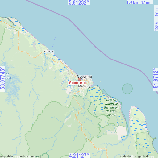
Macouria GPS coordinates[2]
4° 54' 43.776" North, 52° 22' 27.552" West
| Map corner | latitude | longitude |
|---|---|---|
| Upper-left | 5.61232°, | -53.07745° |
| Center: | 4.91216°, | -52.37432° |
| Lower-right: | 4.21127°, | -51.6712° |
| Map W x H: | 155.8×155.8 km | = 96.8×96.8mi |
| max Lat: | 5.66906° ⇑52.9% North |
| Macouria: | 4.91216° |
| min Lat: | ⇓47.1% South 3.16887° |
| min Long | Macouria | max Long |
| -54.38146° | -52.37432° | -51.80243° |
| W 52.9%⇐ | ⇒47.1% E |
Elevation
Elevation of Macouria is 14 m = 46 ft, and this is 9.9 m = 32 ft below average elevation for this country.
| Max E: |
106 m = 348 ft | 41.2% |
| Avg. | 23.9 m = 78 ft | |
| Macouria | 14 m = 46 ft | |
Min E: |
1 m = 3 ft | 58.8% |
See also: French Guiana elevation on elevation.city.
Geographical zone
Macouria is located in North Torrid zone (between Equator and Tropic of Cancer). Distance of Equator is 546.2 km =339.4 mi to South.| Distance of | km | miles | from Macouria |
|---|---|---|---|
| North Pole | 9460.9 | 5878.7 | to North |
| Arctic Circle | 6855 | 4259.5 | to North |
| Tropic Cancer | 2059.7 | 1279.8 | to North |
| Equator | 546.2 | 339.4 | to South |


Nearby cities:
15 places around Macouria: (largest is in red/bold)
• Apatou
219.7 km =136.5 mi,  277°
277°
• Camopi
193.9 km =120.5 mi,  178°
178°
• Cayenne
5.1 km =3.2 mi,  62°
62°
• Iracoubo
111.6 km =69.3 mi,  304°
304°
• Kourou
40.7 km =25.3 mi,  313°
313°
• Mana
176.8 km =109.9 mi, 298°
• Matoury
9 km =5.6 mi,  141°
141°
• Roura
21.1 km =13.1 mi,  164°
164°
• Régina
71.9 km =44.7 mi, 157°
• Rémire
11 km =6.8 mi,  105°
105°
• Rémire-Montjoly
11.9 km =7.4 mi,  87°
87°
• Saint-Georges
130.3 km =81 mi,  150°
150°
• Saint-Laurent-du-Maroni
194.6 km =120.9 mi,  289°
289°
• Sinnamary
82.6 km =51.3 mi, 308°
• Tonate
15.5 km =9.6 mi,  315°
315°
Sources, notices
• [Note1] Compared only with cities in French Guiana existing in our database
• [Src1] Map data: © OpenStreetMap contributors (CC-BY-SA)
• [Src2] Other city data from geonames.org with taken over terms of usage.
• [Src3] Geographical zone / Annual Mean Temperature by Robert A. Rohde @ Wikipedia
