Cayenne geodata
Cayenne (Guyane) is a capital of a political entity; located in French Guiana in America/Cayenne (GMT-3) time zone. With population of 61,550 people, there are 0 cities with bigger population in this country. Compared to other cities in French Guiana, 58.8% of cities are located further ↓South; 64.7% of cities are located further ←West and 76.5% of cities have higher elevation than Cayenne. Note1
Administrative division(s):
- Level 1: Guyane
- Level 2: Guyane
- Level 3: Arrondissement de Cayenne
- Level 4: Cayenne


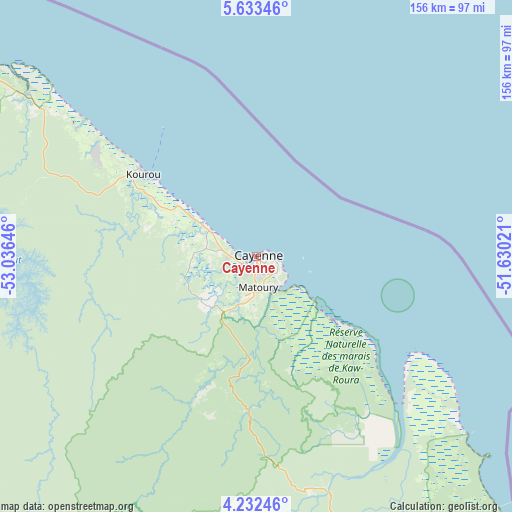
Cayenne GPS coordinates[2]
4° 55' 59.988" North, 52° 19' 59.988" West
| Map corner | latitude | longitude |
|---|---|---|
| Upper-left | 5.63346°, | -53.03646° |
| Center: | 4.93333°, | -52.33333° |
| Lower-right: | 4.23246°, | -51.63021° |
| Map W x H: | 155.8×155.8 km | = 96.8×96.8mi |
| max Lat: | 5.66906° ⇑41.2% North |
| Cayenne: | 4.93333° |
| min Lat: | ⇓58.8% South 3.16887° |
| min Long | Cayenne | max Long |
| -54.38146° | -52.33333° | -51.80243° |
| W 64.7%⇐ | ⇒35.3% E |
Elevation
Elevation of Cayenne is 7 m = 23 ft, and this is 16.9 m = 55 ft below average elevation for this country.
| Max E: |
106 m = 348 ft | 76.5% |
| Avg. | 23.9 m = 78 ft | |
| Cayenne | 7 m = 23 ft | |
Min E: |
1 m = 3 ft | 23.5% |
See also: Cayenne elevation on elevation.city.
Geographical zone
Cayenne is located in North Torrid zone (between Equator and Tropic of Cancer). Distance of Equator is 548.5 km =340.8 mi to South.| Distance of | km | miles | from Cayenne |
|---|---|---|---|
| North Pole | 9458.5 | 5877.2 | to North |
| Arctic Circle | 6852.6 | 4258 | to North |
| Tropic Cancer | 2057.4 | 1278.4 | to North |
| Equator | 548.5 | 340.8 | to South |


Nearby cities:
15 places around Cayenne: (largest is in red/bold)
• Apatou
224 km =139.2 mi,  276°
276°
• Camopi
196.2 km =121.9 mi,  180°
180°
• Iracoubo
114.1 km =70.9 mi,  302°
302°
• Kourou
42.7 km =26.5 mi,  306°
306°
• Macouria
5.1 km =3.2 mi,  242°
242°
• Mana
179.7 km =111.7 mi, 297°
• Matoury
9.4 km =5.8 mi,  173°
173°
• Roura
22.8 km =14.2 mi, 177°
• Régina
72.5 km =45 mi,  161°
161°
• Rémire
8 km =5 mi,  131°
131°
• Rémire-Montjoly
7.6 km =4.7 mi,  104°
104°
• Saint-Georges
130.2 km =80.9 mi,  153°
153°
• Saint-Laurent-du-Maroni
198.1 km =123.1 mi,  288°
288°
• Sinnamary
84.8 km =52.7 mi, 305°
• Tonate
17.7 km =11 mi, 299°
Sources, notices
• [Note1] Compared only with cities in French Guiana existing in our database
• [Src1] Map data: © OpenStreetMap contributors (CC-BY-SA)
• [Src2] Other city data from geonames.org with taken over terms of usage.
• [Src3] Geographical zone / Annual Mean Temperature by Robert A. Rohde @ Wikipedia
