Maripasoula geodata
Maripasoula (Guyane) is a seat of a third-order administrative division; located in French Guiana in America/Cayenne (GMT-3) time zone. In our database, there are 14 cities with bigger population. Compared to other cities in French Guiana, 94.1% of cities are located further ↑North; 88.2% of cities are located further →East and 100% of cities have lower elevation than Maripasoula. Note1
Administrative division(s):
- Level 1: Guyane
- Level 2: Guyane
- Level 3: Arrondissement de Saint-Laurent-du-Maroni
- Level 4: Maripasoula


Maripasoula GPS coordinates[2]
3° 38' 29.58" North, 54° 1' 54.012" West
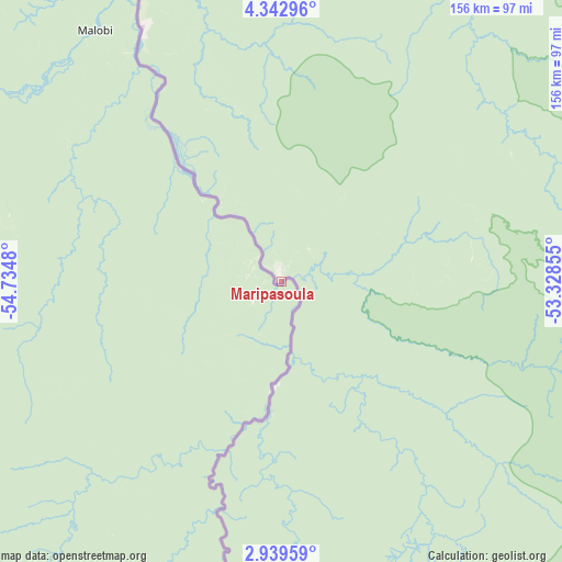
| Map corner | latitude | longitude |
|---|---|---|
| Upper-left | 4.34296°, | -54.7348° |
| Center: | 3.64155°, | -54.03167° |
| Lower-right: | 2.93959°, | -53.32855° |
| Map W x H: | 156×156 km | = 96.9×96.9mi |
| max Lat: | 5.66906° ⇑94.1% North |
| Maripasoula: | 3.64155° |
| min Lat: | ⇓5.9% South 3.16887° |
| min Long | Maripasoula | max Long |
| -54.38146° | -54.03167° | -51.80243° |
| W 11.8%⇐ | ⇒88.2% E |
Elevation
Elevation of Maripasoula is 106 m = 348 ft, and this is 82.1 m = 269 ft above average elevation for this country.
| Max E: |
106 m = 348 ft | 0% |
| Maripasoula | 106 m 348 ft | |
| Avg. | 23.9 m = 78 ft | |
Min E: |
1 m = 3 ft | 100% |
See also: French Guiana elevation on elevation.city.
Geographical zone
Maripasoula is located in North Torrid zone (between Equator and Tropic of Cancer). Distance of Equator is 404.9 km =251.6 mi to South.| Distance of | km | miles | from Maripasoula |
|---|---|---|---|
| North Pole | 9602.2 | 5966.5 | to North |
| Arctic Circle | 6996.3 | 4347.3 | to North |
| Tropic Cancer | 2201 | 1367.6 | to North |
| Equator | 404.9 | 251.6 | to South |


Nearby cities:
15 places around Maripasoula: (largest is in red/bold)
• Apatou
171.8 km =106.8 mi,  348°
348°
• Camopi
195.5 km =121.5 mi,  105°
105°
• Cayenne
236.8 km =147.1 mi,  52°
52°
• Grand-Santi
80.2 km =49.8 mi,  331°
331°
• Iracoubo
224 km =139.2 mi,  24°
24°
• Kourou
228.7 km =142.1 mi,  42°
42°
• Macouria
231.8 km =144 mi, 52°
• Mana
227.2 km =141.2 mi,  7°
7°
• Matoury
232.2 km =144.3 mi, 54°
• Roura
224.6 km =139.6 mi,  57°
57°
• Régina
223.7 km =139 mi,  70°
70°
• Rémire
238.6 km =148.3 mi, 54°
• Saint-Laurent-du-Maroni
206.8 km =128.5 mi,  0°
0°
• Sinnamary
226.8 km =140.9 mi,  31°
31°
• Tonate
230.4 km =143.2 mi, 48°
Sources, notices
• [Note1] Compared only with cities in French Guiana existing in our database
• [Src1] Map data: © OpenStreetMap contributors (CC-BY-SA)
• [Src2] Other city data from geonames.org with taken over terms of usage.
• [Src3] Geographical zone / Annual Mean Temperature by Robert A. Rohde @ Wikipedia
