Quinhámel geodata
Quinhámel (Biombo) is a seat of a first-order administrative division; located in Guinea-Bissau in Africa/Bissau (GMT+0) time zone. With population of 3,128 people, there are 13 cities with bigger population in this country. Compared to other cities in Guinea-Bissau, 56.2% of cities are located further ↑North; 87.5% of cities are located further →East and 56.2% of cities have higher elevation than Quinhámel. Note1


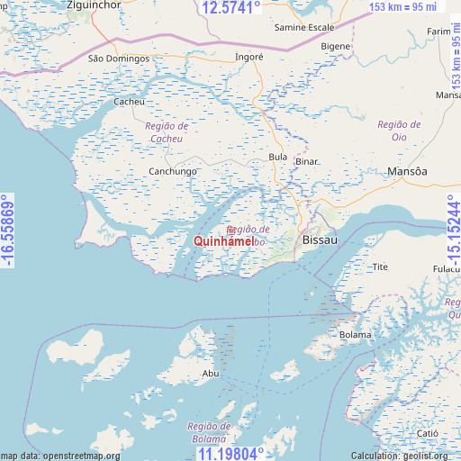
Quinhámel GPS coordinates[2]
11° 53' 12.984" North, 15° 51' 20.016" West
| Map corner | latitude | longitude |
|---|---|---|
| Upper-left | 12.5741°, | -16.55869° |
| Center: | 11.88694°, | -15.85556° |
| Lower-right: | 11.19804°, | -15.15244° |
| Map W x H: | 153×153 km | = 95.1×95.1mi |
| max Lat: | 12.66286° ⇑56.2% North |
| Quinhámel: | 11.88694° |
| min Lat: | ⇓43.8% South 11.2825° |
| min Long | Quinhámel | max Long |
| -16.16528° | -15.85556° | -13.95343° |
| W 12.5%⇐ | ⇒87.5% E |
Elevation
Elevation of Quinhámel is 21 m = 69 ft, and this is 6.4 m = 21 ft below average elevation for this country.
| Max E: |
64 m = 210 ft | 56.2% |
| Avg. | 27.4 m = 90 ft | |
| Quinhámel | 21 m = 69 ft | |
Min E: |
8 m = 26 ft | 43.8% |
See also: Guinea-Bissau elevation on elevation.city.
Geographical zone
Quinhámel is located in North Torrid zone (between Equator and Tropic of Cancer). Distance of this Northern Tropic circle is 1284.2 km =798 mi to North.| Distance of | km | miles | from Quinhámel |
|---|---|---|---|
| North Pole | 8685.4 | 5396.9 | to North |
| Arctic Circle | 6079.5 | 3777.6 | to North |
| Tropic Cancer | 1284.2 | 798 | to North |
| Equator | 1321.7 | 821.3 | to South |


Nearby cities:
15 places around Quinhámel: (largest is in red/bold)
• Bafatá
133.5 km =83 mi,  76°
76°
• Bissau
28.2 km =17.5 mi,  95°
95°
• Bissorã
58 km =36 mi,  49°
49°
• Bolama
53.8 km =33.4 mi,  129°
129°
• Buba
99.3 km =61.7 mi,  109°
109°
• Bubaque
67.2 km =41.8 mi,  177°
177°
• Cacheu
54.7 km =34 mi,  321°
321°
• Canchungo
27.9 km =17.3 mi, 316°
• Catió
93.8 km =58.3 mi,  135°
135°
• Farim
95.7 km =59.5 mi, 46°
• Fulacunda
75.4 km =46.9 mi, 99°
• Gabú
182.9 km =113.6 mi, 76°
• Mansôa
61.9 km =38.5 mi,  70°
70°
• Pirada
204 km =126.8 mi,  64°
64°
• Quebo
117.8 km =73.2 mi,  121°
121°
Sources, notices
• [Note1] Compared only with cities in Guinea-Bissau existing in our database
• [Src1] Map data: © OpenStreetMap contributors (CC-BY-SA)
• [Src2] Other city data from geonames.org with taken over terms of usage.
• [Src3] Geographical zone / Annual Mean Temperature by Robert A. Rohde @ Wikipedia
