Gabú geodata
Gabú is a seat of a first-order administrative division; located in Guinea-Bissau in Africa/Bissau (GMT+0) time zone. With population of 14,430 people, there are 2 cities with bigger population in this country. Compared to other cities in Guinea-Bissau, 81.3% of cities are located further ↓South; 87.5% of cities are located further ←West and 100% of cities have lower elevation than Gabú. Note1


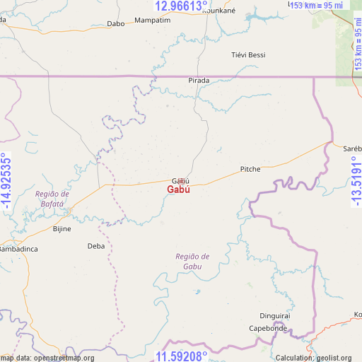
Gabú GPS coordinates[2]
12° 16' 48" North, 14° 13' 19.992" West
| Map corner | latitude | longitude |
|---|---|---|
| Upper-left | 12.96613°, | -14.92535° |
| Center: | 12.28°, | -14.22222° |
| Lower-right: | 11.59208°, | -13.5191° |
| Map W x H: | 152.8×152.8 km | = 94.9×94.9mi |
| max Lat: | 12.66286° ⇑18.7% North |
| Gabú: | 12.28° |
| min Lat: | ⇓81.3% South 11.2825° |
| min Long | Gabú | max Long |
| -16.16528° | -14.22222° | -13.95343° |
| W 87.5%⇐ | ⇒12.5% E |
Elevation
Elevation of Gabú is 64 m = 210 ft, and this is 36.6 m = 120 ft above average elevation for this country.
| Max E: |
64 m = 210 ft | 0% |
| Gabú | 64 m 210 ft | |
| Avg. | 27.4 m = 90 ft | |
Min E: |
8 m = 26 ft | 100% |
See also: Guinea-Bissau elevation on elevation.city.
Geographical zone
Gabú is located in North Torrid zone (between Equator and Tropic of Cancer). Distance of this Northern Tropic circle is 1240.5 km =770.8 mi to North.| Distance of | km | miles | from Gabú |
|---|---|---|---|
| North Pole | 8641.7 | 5369.7 | to North |
| Arctic Circle | 6035.8 | 3750.5 | to North |
| Tropic Cancer | 1240.5 | 770.8 | to North |
| Equator | 1365.4 | 848.4 | to South |


Nearby cities:
15 places around Gabú: (largest is in red/bold)
• Bafatá
49.4 km =30.7 mi,  255°
255°
• Bissau
156.6 km =97.3 mi,  252°
252°
• Bissorã
133.3 km =82.8 mi,  267°
267°
• Bolama
157.2 km =97.7 mi,  240°
240°
• Buba
114 km =70.8 mi,  227°
227°
• Bubaque
207.4 km =128.9 mi, 237°
• Canchungo
198.3 km =123.2 mi, 263°
• Catió
157.9 km =98.1 mi, 225°
• Farim
110.9 km =68.9 mi,  281°
281°
• Fulacunda
117.5 km =73 mi, 241°
• Mansôa
121.4 km =75.4 mi, 259°
• Pirada
43.2 km =26.8 mi,  9°
9°
• Pitche
29.6 km =18.4 mi,  80°
80°
• Quebo
130.7 km =81.2 mi,  216°
216°
• Quinhámel
182.9 km =113.6 mi, 256°
Sources, notices
• [Note1] Compared only with cities in Guinea-Bissau existing in our database
• [Src1] Map data: © OpenStreetMap contributors (CC-BY-SA)
• [Src2] Other city data from geonames.org with taken over terms of usage.
• [Src3] Geographical zone / Annual Mean Temperature by Robert A. Rohde @ Wikipedia
