Cacheu geodata
Cacheu is a seat of a first-order administrative division; located in Guinea-Bissau in Africa/Bissau (GMT+0) time zone. With population of 10,490 people, there are 5 cities with bigger population in this country. Compared to other cities in Guinea-Bissau, 75% of cities are located further ↓South; 100% of cities are located further →East and 75% of cities have higher elevation than Cacheu. Note1


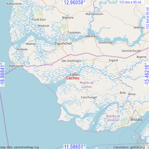
Cacheu GPS coordinates[2]
12° 16' 27.984" North, 16° 9' 55.008" West
| Map corner | latitude | longitude |
|---|---|---|
| Upper-left | 12.96058°, | -16.86841° |
| Center: | 12.27444°, | -16.16528° |
| Lower-right: | 11.58651°, | -15.46216° |
| Map W x H: | 152.8×152.8 km | = 94.9×94.9mi |
| max Lat: | 12.66286° ⇑25% North |
| Cacheu: | 12.27444° |
| min Lat: | ⇓75% South 11.2825° |
| min Long | Cacheu | max Long |
| -16.16528° | -16.16528° | -13.95343° |
| W 0%⇐ | ⇒100% E |
Elevation
Elevation of Cacheu is 18 m = 59 ft, and this is 9.4 m = 31 ft below average elevation for this country.
| Max E: |
64 m = 210 ft | 75% |
| Avg. | 27.4 m = 90 ft | |
| Cacheu | 18 m = 59 ft | |
Min E: |
8 m = 26 ft | 25% |
See also: Guinea-Bissau elevation on elevation.city.
Geographical zone
Cacheu is located in North Torrid zone (between Equator and Tropic of Cancer). Distance of this Northern Tropic circle is 1241.1 km =771.2 mi to North.| Distance of | km | miles | from Cacheu |
|---|---|---|---|
| North Pole | 8642.3 | 5370.1 | to North |
| Arctic Circle | 6036.4 | 3750.8 | to North |
| Tropic Cancer | 1241.1 | 771.2 | to North |
| Equator | 1364.8 | 848 | to South |


Nearby cities:
15 places around Cacheu: (largest is in red/bold)
• Bafatá
163.8 km =101.8 mi,  94°
94°
• Bissau
76.8 km =47.7 mi,  126°
126°
• Bissorã
78.2 km =48.6 mi, 94°
• Bolama
107.9 km =67 mi,  135°
135°
• Buba
148.3 km =92.1 mi,  120°
120°
• Bubaque
116 km =72.1 mi,  161°
161°
• Canchungo
27.1 km =16.8 mi,  148°
148°
• Catió
148.3 km =92.1 mi, 138°
• Farim
105.1 km =65.3 mi,  77°
77°
• Fulacunda
121.4 km =75.4 mi, 117°
• Gabú
211.1 km =131.2 mi, 89°
• Mansôa
94.7 km =58.8 mi,  103°
103°
• Pirada
222.6 km =138.3 mi, 78°
• Quebo
170.1 km =105.7 mi, 127°
• Quinhámel
54.7 km =34 mi, 141°
Sources, notices
• [Note1] Compared only with cities in Guinea-Bissau existing in our database
• [Src1] Map data: © OpenStreetMap contributors (CC-BY-SA)
• [Src2] Other city data from geonames.org with taken over terms of usage.
• [Src3] Geographical zone / Annual Mean Temperature by Robert A. Rohde @ Wikipedia
