Pitche geodata
Pitche (Gabú) is a seat of a second-order administrative division; located in Guinea-Bissau in Africa/Bissau (GMT+0) time zone. In our database, there are 14 cities with bigger population. Compared to other cities in Guinea-Bissau, 87.5% of cities are located further ↓South; 100% of cities are located further ←West and 93.8% of cities have lower elevation than Pitche. Note1


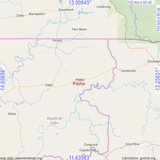
Pitche GPS coordinates[2]
12° 19' 24.384" North, 13° 57' 12.348" West
| Map corner | latitude | longitude |
|---|---|---|
| Upper-left | 13.00945°, | -14.65656° |
| Center: | 12.32344°, | -13.95343° |
| Lower-right: | 11.63563°, | -13.25031° |
| Map W x H: | 152.8×152.8 km | = 94.9×94.9mi |
| max Lat: | 12.66286° ⇑12.5% North |
| Pitche: | 12.32344° |
| min Lat: | ⇓87.5% South 11.2825° |
| min Long | Pitche | max Long |
| -16.16528° | -13.95343° | -13.95343° |
| W 100%⇐ | ⇒0% E |
Elevation
Elevation of Pitche is 62 m = 203 ft, and this is 34.6 m = 114 ft above average elevation for this country.
| Max E: |
64 m = 210 ft | 6.2% |
| Pitche | 62 m 203 ft | |
| Avg. | 27.4 m = 90 ft | |
Min E: |
8 m = 26 ft | 93.8% |
See also: Guinea-Bissau elevation on elevation.city.
Geographical zone
Pitche is located in North Torrid zone (between Equator and Tropic of Cancer). Distance of this Northern Tropic circle is 1235.7 km =767.8 mi to North.| Distance of | km | miles | from Pitche |
|---|---|---|---|
| North Pole | 8636.8 | 5366.7 | to North |
| Arctic Circle | 6030.9 | 3747.4 | to North |
| Tropic Cancer | 1235.7 | 767.8 | to North |
| Equator | 1370.2 | 851.4 | to South |


Nearby cities:
15 places around Pitche: (largest is in red/bold)
• Bafatá
78.9 km =49 mi,  257°
257°
• Bissau
185.9 km =115.5 mi,  254°
254°
• Bissorã
162.7 km =101.1 mi,  266°
266°
• Bolama
185.3 km =115.1 mi,  243°
243°
• Buba
139.7 km =86.8 mi,  234°
234°
• Bubaque
235 km =146 mi, 240°
• Canchungo
227.8 km =141.5 mi, 262°
• Catió
182.9 km =113.6 mi, 230°
• Farim
138.9 km =86.3 mi,  277°
277°
• Fulacunda
145.8 km =90.6 mi, 245°
• Gabú
29.6 km =18.4 mi, 260°
• Mansôa
151 km =93.8 mi, 259°
• Pirada
43.6 km =27.1 mi,  329°
329°
• Quebo
153.3 km =95.3 mi,  224°
224°
• Quinhámel
212.4 km =132 mi, 256°
Sources, notices
• [Note1] Compared only with cities in Guinea-Bissau existing in our database
• [Src1] Map data: © OpenStreetMap contributors (CC-BY-SA)
• [Src2] Other city data from geonames.org with taken over terms of usage.
• [Src3] Geographical zone / Annual Mean Temperature by Robert A. Rohde @ Wikipedia
