Rosignol geodata
Rosignol (Mahaica-Berbice) is a populated place; located in Guyana in America/Guyana (GMT-4) time zone. With population of 5,782 people, there are 6 cities with bigger population in this country. Compared to other cities in Guyana, 64.3% of cities are located further ↑North; 85.7% of cities are located further ←West and 85.7% of cities have higher elevation than Rosignol. Note1


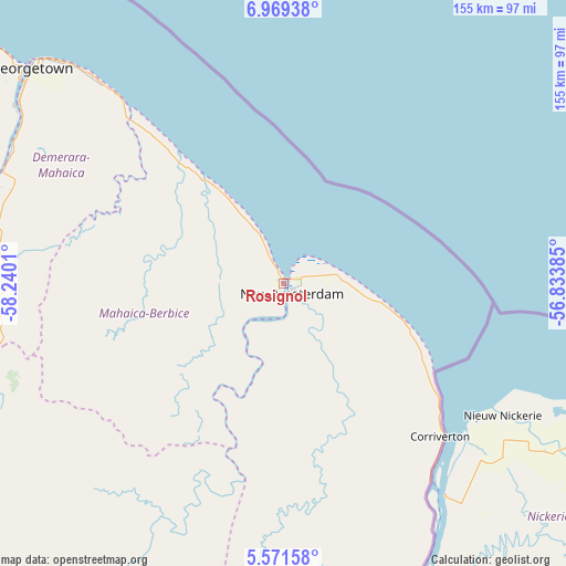
Rosignol GPS coordinates[2]
6° 16' 15.42" North, 57° 32' 13.092" West
| Map corner | latitude | longitude |
|---|---|---|
| Upper-left | 6.96938°, | -58.2401° |
| Center: | 6.27095°, | -57.53697° |
| Lower-right: | 5.57158°, | -56.83385° |
| Map W x H: | 155.4×155.4 km | = 96.6×96.6mi |
| max Lat: | 8.2° ⇑64.3% North |
| Rosignol: | 6.27095° |
| min Lat: | ⇓35.7% South 3.38333° |
| min Long | Rosignol | max Long |
| -59.8° | -57.53697° | -57.13333° |
| W 85.7%⇐ | ⇒14.3% E |
Elevation
Elevation of Rosignol is 3 m = 10 ft, and this is 12.3 m = 40 ft below average elevation for this country.
| Max E: |
85 m = 279 ft | 85.7% |
| Avg. | 15.3 m = 50 ft | |
| Rosignol | 3 m = 10 ft | |
Min E: |
0 m = 0 ft | 14.3% |
See also: Guyana elevation on elevation.city.
Geographical zone
Rosignol is located in North Torrid zone (between Equator and Tropic of Cancer). Distance of Equator is 697.3 km =433.3 mi to South.| Distance of | km | miles | from Rosignol |
|---|---|---|---|
| North Pole | 9309.8 | 5784.8 | to North |
| Arctic Circle | 6703.9 | 4165.6 | to North |
| Tropic Cancer | 1908.7 | 1186 | to North |
| Equator | 697.3 | 433.3 | to South |


Nearby cities:
14 places around Rosignol: (largest is in red/bold)
• Anna Regina
153.9 km =95.6 mi,  315°
315°
• Bartica
120.9 km =75.1 mi,  277°
277°
• Fort Wellington
15.2 km =9.4 mi,  331°
331°
• Georgetown
90.5 km =56.2 mi,  310°
310°
• Lethem
407.4 km =253.1 mi,  217°
217°
• Linden
90 km =55.9 mi,  251°
251°
• Mabaruma
327.7 km =203.6 mi, 310°
• Mahaica Village
62.6 km =38.9 mi, 317°
• Mahaicony Village
45 km =28 mi, 318°
• Mahdia
210.5 km =130.8 mi,  237°
237°
• New Amsterdam
3.4 km =2.1 mi,  139°
139°
• Parika
117 km =72.7 mi,  302°
302°
• Skeldon
62 km =38.5 mi,  134°
134°
• Vreed-en-Hoop
94.4 km =58.7 mi, 309°
Sources, notices
• [Note1] Compared only with cities in Guyana existing in our database
• [Src1] Map data: © OpenStreetMap contributors (CC-BY-SA)
• [Src2] Other city data from geonames.org with taken over terms of usage.
• [Src3] Geographical zone / Annual Mean Temperature by Robert A. Rohde @ Wikipedia
