Parika geodata
Parika (Essequibo Islands-West Demerara) is a populated place; located in Guyana in America/Guyana (GMT-4) time zone. With population of 4,081 people, there are 9 cities with bigger population in this country. Compared to other cities in Guyana, 85.7% of cities are located further ↓South; 64.3% of cities are located further →East and 78.6% of cities have lower elevation than Parika. Note1


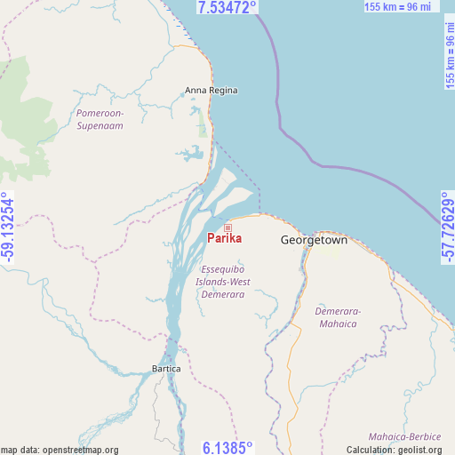
Parika GPS coordinates[2]
6° 50' 13.632" North, 58° 25' 45.876" West
| Map corner | latitude | longitude |
|---|---|---|
| Upper-left | 7.53472°, | -59.13254° |
| Center: | 6.83712°, | -58.42941° |
| Lower-right: | 6.1385°, | -57.72629° |
| Map W x H: | 155.2×155.2 km | = 96.4×96.4mi |
| max Lat: | 8.2° ⇑14.3% North |
| Parika: | 6.83712° |
| min Lat: | ⇓85.7% South 3.38333° |
| min Long | Parika | max Long |
| -59.8° | -58.42941° | -57.13333° |
| W 35.7%⇐ | ⇒64.3% E |
Elevation
Elevation of Parika is 10 m = 33 ft, and this is 5.3 m = 17 ft below average elevation for this country.
| Max E: |
85 m = 279 ft | 21.4% |
| Avg. | 15.3 m = 50 ft | |
| Parika | 10 m = 33 ft | |
Min E: |
0 m = 0 ft | 78.6% |
See also: Guyana elevation on elevation.city.
Geographical zone
Parika is located in North Torrid zone (between Equator and Tropic of Cancer). Distance of Equator is 760.2 km =472.4 mi to South.| Distance of | km | miles | from Parika |
|---|---|---|---|
| North Pole | 9246.8 | 5745.7 | to North |
| Arctic Circle | 6641 | 4126.5 | to North |
| Tropic Cancer | 1845.7 | 1146.9 | to North |
| Equator | 760.2 | 472.4 | to South |


Nearby cities:
14 places around Parika: (largest is in red/bold)
• Anna Regina
48.3 km =30 mi,  349°
349°
• Bartica
52.2 km =32.4 mi,  204°
204°
• Fort Wellington
103.8 km =64.5 mi,  118°
118°
• Georgetown
30.5 km =19 mi,  96°
96°
• Lethem
412.9 km =256.6 mi, 201°
• Linden
93.2 km =57.9 mi,  171°
171°
• Mabaruma
212.7 km =132.2 mi,  315°
315°
• Mahaica Village
58.6 km =36.4 mi,  106°
106°
• Mahaicony Village
74.8 km =46.5 mi, 112°
• Mahdia
191.9 km =119.2 mi, 204°
• New Amsterdam
120.2 km =74.7 mi, 123°
• Rosignol
117 km =72.7 mi, 122°
• Skeldon
178.2 km =110.7 mi,  126°
126°
• Vreed-en-Hoop
25.7 km =16 mi, 96°
Sources, notices
• [Note1] Compared only with cities in Guyana existing in our database
• [Src1] Map data: © OpenStreetMap contributors (CC-BY-SA)
• [Src2] Other city data from geonames.org with taken over terms of usage.
• [Src3] Geographical zone / Annual Mean Temperature by Robert A. Rohde @ Wikipedia
