Fort Wellington geodata
Fort Wellington (Mahaica-Berbice) is a seat of a first-order administrative division; located in Guyana in America/Guyana (GMT-4) time zone. In our database, there are 14 cities with bigger population. Compared to other cities in Guyana, 57.1% of cities are located further ↑North; 78.6% of cities are located further ←West and 92.9% of cities have higher elevation than Fort Wellington. Note1


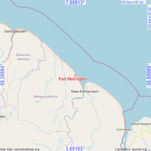
Fort Wellington GPS coordinates[2]
6° 23' 27.132" North, 57° 36' 13.716" West
| Map corner | latitude | longitude |
|---|---|---|
| Upper-left | 7.08913°, | -58.30694° |
| Center: | 6.39087°, | -57.60381° |
| Lower-right: | 5.69165°, | -56.90069° |
| Map W x H: | 155.4×155.4 km | = 96.6×96.6mi |
| max Lat: | 8.2° ⇑57.1% North |
| Fort Wellington: | 6.39087° |
| min Lat: | ⇓42.9% South 3.38333° |
| min Long | Fort Wellington | max Long |
| -59.8° | -57.60381° | -57.13333° |
| W 78.6%⇐ | ⇒21.4% E |
Elevation
Elevation of Fort Wellington is 2 m = 7 ft, and this is 13.3 m = 44 ft below average elevation for this country.
| Max E: |
85 m = 279 ft | 92.9% |
| Avg. | 15.3 m = 50 ft | |
| Fort Wellington | 2 m = 7 ft | |
Min E: |
0 m = 0 ft | 7.1% |
See also: Guyana elevation on elevation.city.
Geographical zone
Fort Wellington is located in North Torrid zone (between Equator and Tropic of Cancer). Distance of Equator is 710.6 km =441.5 mi to South.| Distance of | km | miles | from Fort Wellington |
|---|---|---|---|
| North Pole | 9296.5 | 5776.6 | to North |
| Arctic Circle | 6690.6 | 4157.3 | to North |
| Tropic Cancer | 1895.3 | 1177.7 | to North |
| Equator | 710.6 | 441.5 | to South |


Nearby cities:
14 places around Fort Wellington: (largest is in red/bold)
• Anna Regina
139.3 km =86.6 mi,  314°
314°
• Bartica
112.5 km =69.9 mi,  270°
270°
• Georgetown
76.3 km =47.4 mi, 307°
• Lethem
413.5 km =256.9 mi,  216°
216°
• Linden
88.6 km =55.1 mi,  241°
241°
• Mabaruma
313.4 km =194.7 mi, 309°
• Mahaica Village
47.9 km =29.8 mi, 312°
• Mahaicony Village
30.3 km =18.8 mi, 312°
• Mahdia
211.8 km =131.6 mi,  233°
233°
• New Amsterdam
18.6 km =11.6 mi,  148°
148°
• Parika
103.8 km =64.5 mi,  298°
298°
• Rosignol
15.2 km =9.4 mi, 151°
• Skeldon
76.7 km =47.7 mi,  137°
137°
• Vreed-en-Hoop
80.4 km =50 mi, 305°
Sources, notices
• [Note1] Compared only with cities in Guyana existing in our database
• [Src1] Map data: © OpenStreetMap contributors (CC-BY-SA)
• [Src2] Other city data from geonames.org with taken over terms of usage.
• [Src3] Geographical zone / Annual Mean Temperature by Robert A. Rohde @ Wikipedia
