Chatrā geodata
Chatrā (Jharkhand) is a populated place; located in India in Asia/Kolkata (GMT+5.5) time zone. With population of 46,844 people, there are 941 cities with bigger population in this country. Compared to other cities in India, 59.1% of cities are located further ↓South; 84% of cities are located further ←West and 78.5% of cities have lower elevation than Chatrā. Note1


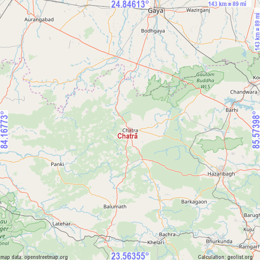
Chatrā GPS coordinates[2]
24° 12' 23.22" North, 84° 52' 15.06" East
| Map corner | latitude | longitude |
|---|---|---|
| Upper-left | 24.84613°, | 84.16773° |
| Center: | 24.20645°, | 84.87085° |
| Lower-right: | 23.56355°, | 85.57398° |
| Map W x H: | 142.6×142.6 km | = 88.6×88.6mi |
| max Lat: | 34.9274° ⇑40.9% North |
| Chatrā: | 24.20645° |
| min Lat: | ⇓59.1% South 8.09008° |
| min Long | Chatrā | max Long |
| 68.82655° | 84.87085° | 96.81° |
| W 84%⇐ | ⇒16% E |
Elevation
Elevation of Chatrā is 440 m = 1444 ft, and this is 144.4 m = 474 ft above average elevation for this country.
| Max E: |
3681 m = 12077 ft | 21.5% |
| Chatrā | 440 m 1444 ft | |
| Avg. | 295.6 m = 970 ft | |
Min E: |
1 m = 3 ft | 78.5% |
See also: Chatrā elevation on elevation.city.
Geographical zone
Chatrā is located in North temperate zone (between Tropic of Cancer and the Arctic Circle). Distance of this Northern Tropic circle is 85.6 km =53.2 mi to South.| Distance of | km | miles | from Chatrā |
|---|---|---|---|
| North Pole | 7315.6 | 4545.7 | to North |
| Arctic Circle | 4709.7 | 2926.5 | to North |
| Tropic Cancer | 85.6 | 53.2 | to South |
| Equator | 2691.5 | 1672.4 | to South |


Nearby cities:
15 places around Chatrā: (largest is in red/bold)
• Aurangābād
78.8 km =49 mi,  320°
320°
• Bagaha
40.7 km =25.3 mi,  28°
28°
• Buddh Gaya
55.9 km =34.7 mi,  12°
12°
• Daltonganj
83.8 km =52.1 mi,  257°
257°
• Gaya
67 km =41.6 mi, 11°
• Hazāribāgh
55.2 km =34.3 mi,  115°
115°
• Jumri Tilaiyā
71.4 km =44.4 mi,  69°
69°
• Kodarmā
78.8 km =49 mi, 68°
• Kuju
84.2 km =52.3 mi,  129°
129°
• Lātehār
63.7 km =39.6 mi,  216°
216°
• Rafiganj
72 km =44.7 mi,  340°
340°
• Rāy
61 km =37.9 mi,  162°
162°
• Sherghāti
40.1 km =24.9 mi,  348°
348°
• Tekāri
81.9 km =50.9 mi,  358°
358°
• patamda
56.3 km =35 mi,  79°
79°
Sources, notices
• [Note1] Compared only with cities in India existing in our database
• [Src1] Map data: © OpenStreetMap contributors (CC-BY-SA)
• [Src2] Other city data from geonames.org with taken over terms of usage.
• [Src3] Geographical zone / Annual Mean Temperature by Robert A. Rohde @ Wikipedia
