Colgong geodata
Colgong (Bihar) is a populated place; located in India in Asia/Kolkata (GMT+5.5) time zone. With population of 24,081 people, there are 1768 cities with bigger population in this country. Compared to other cities in India, 64.9% of cities are located further ↓South; 89.7% of cities are located further ←West and 79.7% of cities have higher elevation than Colgong. Note1


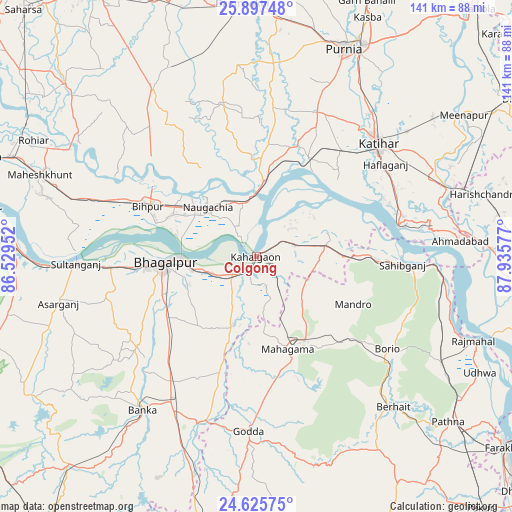
Colgong GPS coordinates[2]
25° 15' 47.808" North, 87° 13' 57.504" East
| Map corner | latitude | longitude |
|---|---|---|
| Upper-left | 25.89748°, | 86.52952° |
| Center: | 25.26328°, | 87.23264° |
| Lower-right: | 24.62575°, | 87.93577° |
| Map W x H: | 141.4×141.4 km | = 87.9×87.9mi |
| max Lat: | 34.9274° ⇑35.1% North |
| Colgong: | 25.26328° |
| min Lat: | ⇓64.9% South 8.09008° |
| min Long | Colgong | max Long |
| 68.82655° | 87.23264° | 96.81° |
| W 89.7%⇐ | ⇒10.3% E |
Elevation
Elevation of Colgong is 49 m = 161 ft, and this is 246.6 m = 809 ft below average elevation for this country.
| Max E: |
3681 m = 12077 ft | 79.7% |
| Avg. | 295.6 m = 970 ft | |
| Colgong | 49 m = 161 ft | |
Min E: |
1 m = 3 ft | 20.3% |
See also: India elevation on elevation.city.
Geographical zone
Colgong is located in North temperate zone (between Tropic of Cancer and the Arctic Circle). Distance of this Northern Tropic circle is 203.1 km =126.2 mi to South.| Distance of | km | miles | from Colgong |
|---|---|---|---|
| North Pole | 7198 | 4472.6 | to North |
| Arctic Circle | 4592.2 | 2853.5 | to North |
| Tropic Cancer | 203.1 | 126.2 | to South |
| Equator | 2809 | 1745.4 | to South |


Nearby cities:
15 places around Colgong: (largest is in red/bold)
• Amarpur
41.5 km =25.8 mi,  233°
233°
• Asarganj
56.4 km =35 mi,  257°
257°
• Banmankhi
69.6 km =43.2 mi,  356°
356°
• Bariārpur
66 km =41 mi,  272°
272°
• Bhāgalpur
26.3 km =16.3 mi, 265°
• Bihārīganj
57.8 km =35.9 mi,  334°
334°
• Bānka
52.8 km =32.8 mi,  216°
216°
• Ghoga
9.2 km =5.7 mi,  236°
236°
• Godda
48.6 km =30.2 mi,  182°
182°
• Katihar
45.7 km =28.4 mi,  47°
47°
• Manihāri
39.8 km =24.7 mi,  77°
77°
• Naugachhia
19.3 km =12 mi,  315°
315°
• Purnia
62.3 km =38.7 mi,  22°
22°
• Rājmahal
64.5 km =40.1 mi,  111°
111°
• Sāhibganj
40.5 km =25.2 mi,  92°
92°
Sources, notices
• [Note1] Compared only with cities in India existing in our database
• [Src1] Map data: © OpenStreetMap contributors (CC-BY-SA)
• [Src2] Other city data from geonames.org with taken over terms of usage.
• [Src3] Geographical zone / Annual Mean Temperature by Robert A. Rohde @ Wikipedia
