Rudraprayāg geodata
Rudraprayāg (Uttarakhand) is a populated place; located in India in Asia/Kolkata (GMT+5.5) time zone. With population of 2,571 people, there are 3422 cities with bigger population in this country. Compared to other cities in India, 93.7% of cities are located further ↓South; 58.9% of cities are located further ←West and 90.6% of cities have lower elevation than Rudraprayāg. Note1


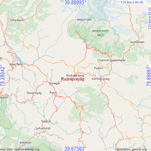
Rudraprayāg GPS coordinates[2]
30° 17' 4.812" North, 78° 59' 0.744" East
| Map corner | latitude | longitude |
|---|---|---|
| Upper-left | 30.88995°, | 78.28042° |
| Center: | 30.28467°, | 78.98354° |
| Lower-right: | 29.67563°, | 79.68667° |
| Map W x H: | 135×135 km | = 83.9×83.9mi |
| max Lat: | 34.9274° ⇑6.3% North |
| Rudraprayāg: | 30.28467° |
| min Lat: | ⇓93.7% South 8.09008° |
| min Long | Rudraprayāg | max Long |
| 68.82655° | 78.98354° | 96.81° |
| W 58.9%⇐ | ⇒41.1% E |
Elevation
Elevation of Rudraprayāg is 646 m = 2119 ft, and this is 350.4 m = 1150 ft above average elevation for this country.
| Max E: |
3681 m = 12077 ft | 9.4% |
| Rudraprayāg | 646 m 2119 ft | |
| Avg. | 295.6 m = 970 ft | |
Min E: |
1 m = 3 ft | 90.6% |
See also: India elevation on elevation.city.
Geographical zone
Rudraprayāg is located in North temperate zone (between Tropic of Cancer and the Arctic Circle). Distance of this Northern Tropic circle is 761.4 km =473.1 mi to South.| Distance of | km | miles | from Rudraprayāg |
|---|---|---|---|
| North Pole | 6639.7 | 4125.7 | to North |
| Arctic Circle | 4033.8 | 2506.5 | to North |
| Tropic Cancer | 761.4 | 473.1 | to South |
| Equator | 3367.3 | 2092.3 | to South |


Nearby cities:
15 places around Rudraprayāg: (largest is in red/bold)
• Birbhaddar
71.5 km =44.4 mi,  250°
250°
• Devaprayāg
39.7 km =24.7 mi, 247°
• Dugadda
64.1 km =39.8 mi,  214°
214°
• Dwārāhāt
70.7 km =43.9 mi,  142°
142°
• Joshīmath
63.3 km =39.3 mi,  61°
61°
• Kedārnāth
49.1 km =30.5 mi,  9°
9°
• Kotdwāra
74.6 km =46.4 mi,  216°
216°
• Lansdowne
57.2 km =35.5 mi, 210°
• Narendranagar
68.3 km =42.4 mi,  258°
258°
• Pauri
24.7 km =15.3 mi,  233°
233°
• Pīpalkoti
45.7 km =28.4 mi,  69°
69°
• Rishīkesh
69.3 km =43.1 mi, 253°
• Srīnagar
20.4 km =12.7 mi, 250°
• Tehri
49.7 km =30.9 mi,  283°
283°
• Uttarkāshi
71.6 km =44.5 mi,  313°
313°
Sources, notices
• [Note1] Compared only with cities in India existing in our database
• [Src1] Map data: © OpenStreetMap contributors (CC-BY-SA)
• [Src2] Other city data from geonames.org with taken over terms of usage.
• [Src3] Geographical zone / Annual Mean Temperature by Robert A. Rohde @ Wikipedia
