Pīpalkoti geodata
Pīpalkoti (Uttarakhand) is a populated place; located in India in Asia/Kolkata (GMT+5.5) time zone. With population of 2,000 people, there are 3431 cities with bigger population in this country. Compared to other cities in India, 94.1% of cities are located further ↓South; 62.9% of cities are located further ←West and 97.3% of cities have lower elevation than Pīpalkoti. Note1


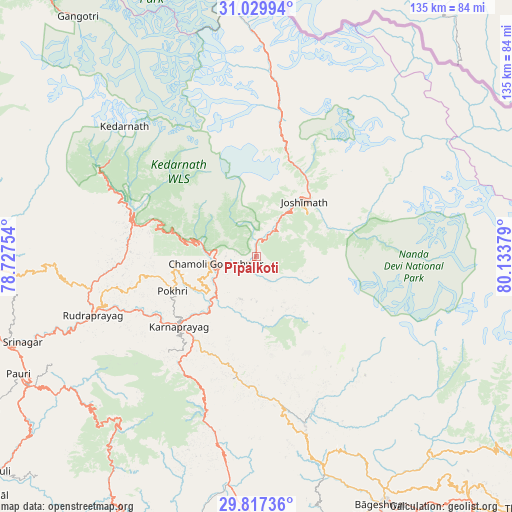
Pīpalkoti GPS coordinates[2]
30° 25' 31.908" North, 79° 25' 50.376" East
| Map corner | latitude | longitude |
|---|---|---|
| Upper-left | 31.02994°, | 78.72754° |
| Center: | 30.42553°, | 79.43066° |
| Lower-right: | 29.81736°, | 80.13379° |
| Map W x H: | 134.8×134.8 km | = 83.8×83.8mi |
| max Lat: | 34.9274° ⇑5.9% North |
| Pīpalkoti: | 30.42553° |
| min Lat: | ⇓94.1% South 8.09008° |
| min Long | Pīpalkoti | max Long |
| 68.82655° | 79.43066° | 96.81° |
| W 62.9%⇐ | ⇒37.1% E |
Elevation
Elevation of Pīpalkoti is 1350 m = 4429 ft, and this is 1054.4 m = 3459 ft above average elevation for this country.
| Max E: |
3681 m = 12077 ft | 2.7% |
| Pīpalkoti | 1350 m 4429 ft | |
| Avg. | 295.6 m = 970 ft | |
Min E: |
1 m = 3 ft | 97.3% |
See also: India elevation on elevation.city.
Geographical zone
Pīpalkoti is located in North temperate zone (between Tropic of Cancer and the Arctic Circle). Distance of this Northern Tropic circle is 777.1 km =482.9 mi to South.| Distance of | km | miles | from Pīpalkoti |
|---|---|---|---|
| North Pole | 6624.1 | 4116 | to North |
| Arctic Circle | 4018.2 | 2496.8 | to North |
| Tropic Cancer | 777.1 | 482.9 | to South |
| Equator | 3383 | 2102.1 | to South |


Nearby cities:
15 places around Pīpalkoti: (largest is in red/bold)
• Almora
94.7 km =58.8 mi,  166°
166°
• Bāgeshwar
73.2 km =45.5 mi,  153°
153°
• Devaprayāg
85.4 km =53.1 mi,  248°
248°
• Dugadda
104.6 km =65 mi,  228°
228°
• Dwārāhāt
72 km =44.7 mi,  180°
180°
• Gangotri
78.7 km =48.9 mi,  323°
323°
• Joshīmath
19.3 km =12 mi,  41°
41°
• Kedārnāth
47.7 km =29.6 mi,  313°
313°
• Lansdowne
97.1 km =60.3 mi, 228°
• Pauri
69.7 km =43.3 mi,  244°
244°
• Rudraprayāg
45.7 km =28.4 mi, 249°
• Rānikhet
87.3 km =54.2 mi, 179°
• Srīnagar
66.1 km =41.1 mi, 250°
• Tehri
91.2 km =56.7 mi,  267°
267°
• Uttarkāshi
100.4 km =62.4 mi,  289°
289°
Sources, notices
• [Note1] Compared only with cities in India existing in our database
• [Src1] Map data: © OpenStreetMap contributors (CC-BY-SA)
• [Src2] Other city data from geonames.org with taken over terms of usage.
• [Src3] Geographical zone / Annual Mean Temperature by Robert A. Rohde @ Wikipedia
