Pauri geodata
Pauri (Uttarakhand) is a populated place; located in India in Asia/Kolkata (GMT+5.5) time zone. With population of 26,514 people, there are 1608 cities with bigger population in this country. Compared to other cities in India, 93.2% of cities are located further ↓South; 56.6% of cities are located further ←West and 97.8% of cities have lower elevation than Pauri. Note1


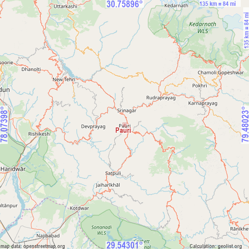
Pauri GPS coordinates[2]
30° 9' 10.296" North, 78° 46' 37.56" East
| Map corner | latitude | longitude |
|---|---|---|
| Upper-left | 30.75896°, | 78.07398° |
| Center: | 30.15286°, | 78.7771° |
| Lower-right: | 29.54301°, | 79.48023° |
| Map W x H: | 135.2×135.2 km | = 84×84mi |
| max Lat: | 34.9274° ⇑6.8% North |
| Pauri: | 30.15286° |
| min Lat: | ⇓93.2% South 8.09008° |
| min Long | Pauri | max Long |
| 68.82655° | 78.7771° | 96.81° |
| W 56.6%⇐ | ⇒43.4% E |
Elevation
Elevation of Pauri is 1532 m = 5026 ft, and this is 1236.4 m = 4056 ft above average elevation for this country.
| Max E: |
3681 m = 12077 ft | 2.2% |
| Pauri | 1532 m 5026 ft | |
| Avg. | 295.6 m = 970 ft | |
Min E: |
1 m = 3 ft | 97.8% |
See also: India elevation on elevation.city.
Geographical zone
Pauri is located in North temperate zone (between Tropic of Cancer and the Arctic Circle). Distance of this Northern Tropic circle is 746.8 km =464 mi to South.| Distance of | km | miles | from Pauri |
|---|---|---|---|
| North Pole | 6654.4 | 4134.9 | to North |
| Arctic Circle | 4048.5 | 2515.6 | to North |
| Tropic Cancer | 746.8 | 464 | to South |
| Equator | 3352.7 | 2083.3 | to South |


Nearby cities:
15 places around Pauri: (largest is in red/bold)
• Birbhaddar
48.5 km =30.1 mi,  259°
259°
• Devaprayāg
16.8 km =10.4 mi,  267°
267°
• Doiwāla
63.6 km =39.5 mi, 272°
• Dugadda
41.7 km =25.9 mi,  202°
202°
• Haridwar
63.6 km =39.5 mi,  249°
249°
• Kedārnāth
69 km =42.9 mi,  23°
23°
• Kotdwāra
51.5 km =32 mi,  208°
208°
• Lansdowne
35.8 km =22.2 mi, 195°
• Narendranagar
47.1 km =29.3 mi, 271°
• Rishīkesh
46.9 km =29.1 mi, 263°
• Rudraprayāg
24.7 km =15.3 mi,  53°
53°
• Rāipur
68.3 km =42.4 mi,  284°
284°
• Rāīwāla Bara
54.8 km =34.1 mi, 254°
• Srīnagar
7.8 km =4.8 mi,  4°
4°
• Tehri
38.9 km =24.2 mi,  312°
312°
Sources, notices
• [Note1] Compared only with cities in India existing in our database
• [Src1] Map data: © OpenStreetMap contributors (CC-BY-SA)
• [Src2] Other city data from geonames.org with taken over terms of usage.
• [Src3] Geographical zone / Annual Mean Temperature by Robert A. Rohde @ Wikipedia
