Kotma geodata
Kotma (Madhya Pradesh) is a populated place; located in India in Asia/Kolkata (GMT+5.5) time zone. With population of 31,756 people, there are 1370 cities with bigger population in this country. Compared to other cities in India, 53% of cities are located further ↓South; 76.5% of cities are located further ←West and 84.2% of cities have lower elevation than Kotma. Note1


Kotma GPS coordinates[2]
23° 12' 13.788" North, 81° 58' 44.544" East
| Map corner | latitude | longitude |
|---|---|---|
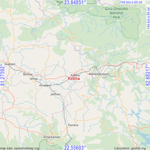
| Upper-left | 23.84851°, | 81.27592° |
| Center: | 23.20383°, | 81.97904° |
| Lower-right: | 22.55603°, | 82.68217° |
| Map W x H: | 143.7×143.7 km | = 89.3×89.3mi |
| max Lat: | 34.9274° ⇑47% North |
| Kotma: | 23.20383° |
| min Lat: | ⇓53% South 8.09008° |
| min Long | Kotma | max Long |
| 68.82655° | 81.97904° | 96.81° |
| W 76.5%⇐ | ⇒23.5% E |
Elevation
Elevation of Kotma is 535 m = 1755 ft, and this is 239.4 m = 785 ft above average elevation for this country.
| Max E: |
3681 m = 12077 ft | 15.8% |
| Kotma | 535 m 1755 ft | |
| Avg. | 295.6 m = 970 ft | |
Min E: |
1 m = 3 ft | 84.2% |
See also: India elevation on elevation.city.
Geographical zone
Kotma is located in North Torrid zone (between Equator and Tropic of Cancer). Distance of this Northern Tropic circle is 25.9 km =16.1 mi to North.| Distance of | km | miles | from Kotma |
|---|---|---|---|
| North Pole | 7427 | 4614.9 | to North |
| Arctic Circle | 4821.2 | 2995.8 | to North |
| Tropic Cancer | 25.9 | 16.1 | to North |
| Equator | 2580 | 1603.1 | to South |


Nearby cities:
15 places around Kotma: (largest is in red/bold)
• Amarkantak
63 km =39.1 mi,  200°
200°
• Anūppur
31.5 km =19.6 mi,  249°
249°
• Baikunthpur
59.8 km =37.2 mi,  83°
83°
• Bodri
56 km =34.8 mi,  265°
265°
• Burhar
45.7 km =28.4 mi, 271°
• Dindori
96.5 km =60 mi, 252°
• Gaurela
50.6 km =31.4 mi,  189°
189°
• Jaisinghnagar
80.5 km =50 mi,  311°
311°
• Katghora
97 km =60.3 mi,  143°
143°
• Kotā
101.1 km =62.8 mi,  177°
177°
• Pasān
45.9 km =28.5 mi,  150°
150°
• Pendra
47.7 km =29.6 mi, 182°
• Pāli
97.2 km =60.4 mi,  280°
280°
• Shahdol
63.8 km =39.6 mi, 278°
• Surajpur
90.9 km =56.5 mi,  89°
89°
Sources, notices
• [Note1] Compared only with cities in India existing in our database
• [Src1] Map data: © OpenStreetMap contributors (CC-BY-SA)
• [Src2] Other city data from geonames.org with taken over terms of usage.
• [Src3] Geographical zone / Annual Mean Temperature by Robert A. Rohde @ Wikipedia
