Jaisalmer geodata
Jaisalmer (Rajasthan) is a populated place; located in India in Asia/Kolkata (GMT+5.5) time zone. With population of 67,604 people, there are 642 cities with bigger population in this country. Compared to other cities in India, 77.9% of cities are located further ↓South; 98.6% of cities are located further →East and 56.9% of cities have lower elevation than Jaisalmer. Note1


Jaisalmer GPS coordinates[2]
26° 55' 3.468" North, 70° 54' 13.932" East
| Map corner | latitude | longitude |
|---|---|---|
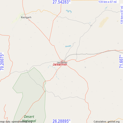
| Upper-left | 27.54283°, | 70.20075° |
| Center: | 26.91763°, | 70.90387° |
| Lower-right: | 26.28895°, | 71.607° |
| Map W x H: | 139.4×139.4 km | = 86.6×86.6mi |
| max Lat: | 34.9274° ⇑22.1% North |
| Jaisalmer: | 26.91763° |
| min Lat: | ⇓77.9% South 8.09008° |
| min Long | Jaisalmer | max Long |
| 68.82655° | 70.90387° | 96.81° |
| W 1.4%⇐ | ⇒98.6% E |
Elevation
Elevation of Jaisalmer is 234 m = 768 ft, and this is 61.6 m = 202 ft below average elevation for this country.
| Max E: |
3681 m = 12077 ft | 43.1% |
| Avg. | 295.6 m = 970 ft | |
| Jaisalmer | 234 m = 768 ft | |
Min E: |
1 m = 3 ft | 56.9% |
See also: Jaisalmer elevation on elevation.city.
Geographical zone
Jaisalmer is located in North temperate zone (between Tropic of Cancer and the Arctic Circle). Distance of this Northern Tropic circle is 387 km =240.5 mi to South.| Distance of | km | miles | from Jaisalmer |
|---|---|---|---|
| North Pole | 7014.1 | 4358.4 | to North |
| Arctic Circle | 4408.2 | 2739.1 | to North |
| Tropic Cancer | 387 | 240.5 | to South |
| Equator | 2993 | 1859.8 | to South |


Nearby cities:
15 places around Jaisalmer: (largest is in red/bold)
• Bhīnmāl
253.3 km =157.4 mi,  147°
147°
• Bālotra
179.6 km =111.6 mi,  132°
132°
• Bārmer
139.1 km =86.4 mi,  159°
159°
• Bīkaner
267.5 km =166.2 mi,  62°
62°
• Deshnoke
260 km =161.6 mi,  67°
67°
• Jalor
244.4 km =151.9 mi,  135°
135°
• Jodhpur
221.1 km =137.4 mi,  109°
109°
• Nokha
263.7 km =163.9 mi, 74°
• Phalodi
147 km =91.3 mi,  80°
80°
• Pokaran
100.4 km =62.4 mi,  89°
89°
• Pāli
272.6 km =169.4 mi,  117°
117°
• Pīpār
269 km =167.1 mi,  102°
102°
• Samdari
207.2 km =128.7 mi, 126°
• Siwāna
206.7 km =128.4 mi, 132°
• Sānchor
255.8 km =158.9 mi, 160°
Sources, notices
• [Note1] Compared only with cities in India existing in our database
• [Src1] Map data: © OpenStreetMap contributors (CC-BY-SA)
• [Src2] Other city data from geonames.org with taken over terms of usage.
• [Src3] Geographical zone / Annual Mean Temperature by Robert A. Rohde @ Wikipedia
