Siwāna geodata
Siwāna (Rajasthan) is a populated place; located in India in Asia/Kolkata (GMT+5.5) time zone. With population of 22,067 people, there are 1902 cities with bigger population in this country. Compared to other cities in India, 68.1% of cities are located further ↓South; 96.9% of cities are located further →East and 52.4% of cities have higher elevation than Siwāna. Note1


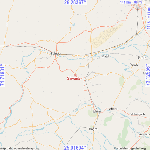
Siwāna GPS coordinates[2]
25° 39' 5.544" North, 72° 25' 20.748" East
| Map corner | latitude | longitude |
|---|---|---|
| Upper-left | 26.28367°, | 71.71931° |
| Center: | 25.65154°, | 72.42243° |
| Lower-right: | 25.01604°, | 73.12556° |
| Map W x H: | 140.9×140.9 km | = 87.6×87.6mi |
| max Lat: | 34.9274° ⇑31.9% North |
| Siwāna: | 25.65154° |
| min Lat: | ⇓68.1% South 8.09008° |
| min Long | Siwāna | max Long |
| 68.82655° | 72.42243° | 96.81° |
| W 3.1%⇐ | ⇒96.9% E |
Elevation
Elevation of Siwāna is 188 m = 617 ft, and this is 107.6 m = 353 ft below average elevation for this country.
| Max E: |
3681 m = 12077 ft | 52.4% |
| Avg. | 295.6 m = 970 ft | |
| Siwāna | 188 m = 617 ft | |
Min E: |
1 m = 3 ft | 47.6% |
See also: India elevation on elevation.city.
Geographical zone
Siwāna is located in North temperate zone (between Tropic of Cancer and the Arctic Circle). Distance of this Northern Tropic circle is 246.3 km =153 mi to South.| Distance of | km | miles | from Siwāna |
|---|---|---|---|
| North Pole | 7154.9 | 4445.8 | to North |
| Arctic Circle | 4549 | 2826.6 | to North |
| Tropic Cancer | 246.3 | 153 | to South |
| Equator | 2852.2 | 1772.3 | to South |


Nearby cities:
15 places around Siwāna: (largest is in red/bold)
• Bhīnmāl
74.1 km =46 mi,  191°
191°
• Bāli
100.8 km =62.6 mi,  120°
120°
• Bālotra
27.2 km =16.9 mi,  317°
317°
• Bārmer
103.8 km =64.5 mi,  275°
275°
• Jalor
39.2 km =24.4 mi,  150°
150°
• Jodhpur
90 km =55.9 mi,  40°
40°
• Pindwāra
114.3 km =71 mi, 146°
• Pāli
91.3 km =56.7 mi,  81°
81°
• Rāni
95.1 km =59.1 mi,  110°
110°
• Samdari
23.8 km =14.8 mi, 41°
• Sheoganj
86.3 km =53.6 mi,  131°
131°
• Sirohi
95 km =59 mi, 153°
• Sādri
115.7 km =71.9 mi, 116°
• Sānchor
119.3 km =74.1 mi,  213°
213°
• Takhatgarh
69 km =42.9 mi, 122°
Sources, notices
• [Note1] Compared only with cities in India existing in our database
• [Src1] Map data: © OpenStreetMap contributors (CC-BY-SA)
• [Src2] Other city data from geonames.org with taken over terms of usage.
• [Src3] Geographical zone / Annual Mean Temperature by Robert A. Rohde @ Wikipedia
