Bārmer geodata
Bārmer (Rajasthan) is a populated place; located in India in Asia/Kolkata (GMT+5.5) time zone. With population of 89,487 people, there are 497 cities with bigger population in this country. Compared to other cities in India, 68.7% of cities are located further ↓South; 98.1% of cities are located further →East and 50.1% of cities have lower elevation than Bārmer. Note1


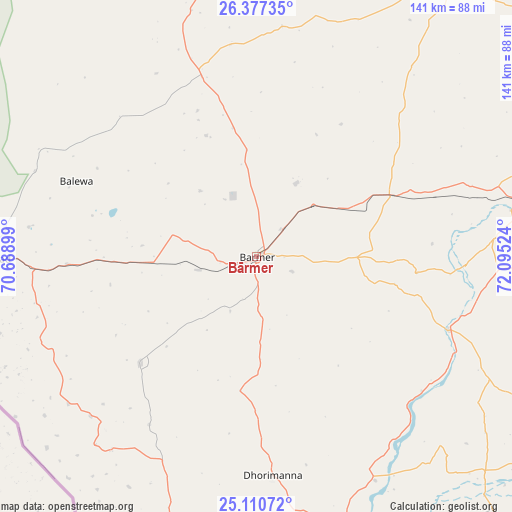
Bārmer GPS coordinates[2]
25° 44' 44.592" North, 71° 23' 31.596" East
| Map corner | latitude | longitude |
|---|---|---|
| Upper-left | 26.37735°, | 70.68899° |
| Center: | 25.74572°, | 71.39211° |
| Lower-right: | 25.11072°, | 72.09524° |
| Map W x H: | 140.8×140.8 km | = 87.5×87.5mi |
| max Lat: | 34.9274° ⇑31.3% North |
| Bārmer: | 25.74572° |
| min Lat: | ⇓68.7% South 8.09008° |
| min Long | Bārmer | max Long |
| 68.82655° | 71.39211° | 96.81° |
| W 1.9%⇐ | ⇒98.1% E |
Elevation
Elevation of Bārmer is 202 m = 663 ft, and this is 93.6 m = 307 ft below average elevation for this country.
| Max E: |
3681 m = 12077 ft | 49.9% |
| Avg. | 295.6 m = 970 ft | |
| Bārmer | 202 m = 663 ft | |
Min E: |
1 m = 3 ft | 50.1% |
See also: Bārmer elevation on elevation.city.
Geographical zone
Bārmer is located in North temperate zone (between Tropic of Cancer and the Arctic Circle). Distance of this Northern Tropic circle is 256.7 km =159.5 mi to South.| Distance of | km | miles | from Bārmer |
|---|---|---|---|
| North Pole | 7144.4 | 4439.3 | to North |
| Arctic Circle | 4538.5 | 2820.1 | to North |
| Tropic Cancer | 256.7 | 159.5 | to South |
| Equator | 2862.7 | 1778.8 | to South |


Nearby cities:
15 places around Bārmer: (largest is in red/bold)
• Bhīnmāl
121.2 km =75.3 mi,  133°
133°
• Bālotra
85.4 km =53.1 mi,  83°
83°
• Dhanera
151.4 km =94.1 mi,  155°
155°
• Jaisalmer
139.1 km =86.4 mi,  339°
339°
• Jalor
130.6 km =81.2 mi,  109°
109°
• Jodhpur
171.4 km =106.5 mi,  70°
70°
• Phalodi
182.1 km =113.2 mi,  32°
32°
• Pokaran
140.6 km =87.4 mi,  21°
21°
• Samdari
119 km =73.9 mi,  86°
86°
• Sheoganj
181.3 km =112.7 mi, 111°
• Sirohi
174.6 km =108.5 mi,  123°
123°
• Siwāna
103.8 km =64.5 mi,  95°
95°
• Sānchor
116.8 km =72.6 mi, 160°
• Takhatgarh
168.5 km =104.7 mi, 106°
• Tharād
151.9 km =94.4 mi,  171°
171°
Sources, notices
• [Note1] Compared only with cities in India existing in our database
• [Src1] Map data: © OpenStreetMap contributors (CC-BY-SA)
• [Src2] Other city data from geonames.org with taken over terms of usage.
• [Src3] Geographical zone / Annual Mean Temperature by Robert A. Rohde @ Wikipedia
