Bālotra geodata
Bālotra (Rajasthan) is a populated place; located in India in Asia/Kolkata (GMT+5.5) time zone. With population of 68,120 people, there are 637 cities with bigger population in this country. Compared to other cities in India, 69.1% of cities are located further ↓South; 97.2% of cities are located further →East and 65.8% of cities have higher elevation than Bālotra. Note1


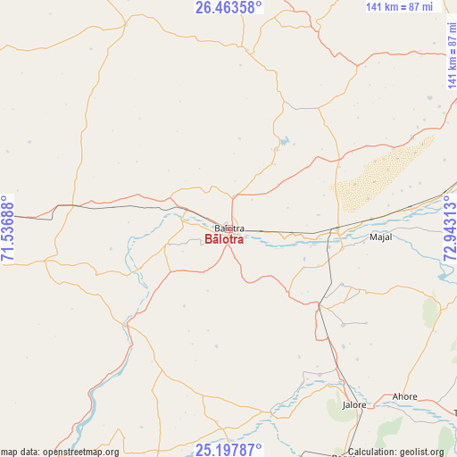
Bālotra GPS coordinates[2]
25° 49' 56.712" North, 72° 14' 24" East
| Map corner | latitude | longitude |
|---|---|---|
| Upper-left | 26.46358°, | 71.53688° |
| Center: | 25.83242°, | 72.24° |
| Lower-right: | 25.19787°, | 72.94313° |
| Map W x H: | 140.7×140.7 km | = 87.4×87.4mi |
| max Lat: | 34.9274° ⇑30.9% North |
| Bālotra: | 25.83242° |
| min Lat: | ⇓69.1% South 8.09008° |
| min Long | Bālotra | max Long |
| 68.82655° | 72.24° | 96.81° |
| W 2.8%⇐ | ⇒97.2% E |
Elevation
Elevation of Bālotra is 115 m = 377 ft, and this is 180.6 m = 593 ft below average elevation for this country.
| Max E: |
3681 m = 12077 ft | 65.8% |
| Avg. | 295.6 m = 970 ft | |
| Bālotra | 115 m = 377 ft | |
Min E: |
1 m = 3 ft | 34.2% |
See also: Bālotra elevation on elevation.city.
Geographical zone
Bālotra is located in North temperate zone (between Tropic of Cancer and the Arctic Circle). Distance of this Northern Tropic circle is 266.4 km =165.5 mi to South.| Distance of | km | miles | from Bālotra |
|---|---|---|---|
| North Pole | 7134.8 | 4433.4 | to North |
| Arctic Circle | 4528.9 | 2814.1 | to North |
| Tropic Cancer | 266.4 | 165.5 | to South |
| Equator | 2872.3 | 1784.8 | to South |


Nearby cities:
15 places around Bālotra: (largest is in red/bold)
• Bhīnmāl
92.7 km =57.6 mi,  178°
178°
• Bāli
126.9 km =78.9 mi,  123°
123°
• Bārmer
85.4 km =53.1 mi,  263°
263°
• Jalor
65.9 km =40.9 mi,  145°
145°
• Jodhpur
90.6 km =56.3 mi,  57°
57°
• Pindwāra
141.3 km =87.8 mi,  144°
144°
• Pokaran
125.2 km =77.8 mi,  345°
345°
• Pāli
108.6 km =67.5 mi,  93°
93°
• Rāni
119.8 km =74.4 mi, 116°
• Samdari
34 km =21.1 mi, 93°
• Sheoganj
113.3 km =70.4 mi,  132°
132°
• Sirohi
121.4 km =75.4 mi, 149°
• Siwāna
27.2 km =16.9 mi, 137°
• Sānchor
128.8 km =80 mi,  201°
201°
• Takhatgarh
95.4 km =59.3 mi, 126°
Sources, notices
• [Note1] Compared only with cities in India existing in our database
• [Src1] Map data: © OpenStreetMap contributors (CC-BY-SA)
• [Src2] Other city data from geonames.org with taken over terms of usage.
• [Src3] Geographical zone / Annual Mean Temperature by Robert A. Rohde @ Wikipedia
