Sirohi geodata
Sirohi (Rajasthan) is a populated place; located in India in Asia/Kolkata (GMT+5.5) time zone. With population of 38,610 people, there are 1140 cities with bigger population in this country. Compared to other cities in India, 62.9% of cities are located further ↓South; 95.7% of cities are located further →East and 66% of cities have lower elevation than Sirohi. Note1


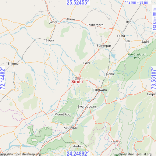
Sirohi GPS coordinates[2]
24° 53' 18.168" North, 72° 50' 52.584" East
| Map corner | latitude | longitude |
|---|---|---|
| Upper-left | 25.52455°, | 72.14482° |
| Center: | 24.88838°, | 72.84794° |
| Lower-right: | 24.24892°, | 73.55107° |
| Map W x H: | 141.8×141.8 km | = 88.1×88.1mi |
| max Lat: | 34.9274° ⇑37.1% North |
| Sirohi: | 24.88838° |
| min Lat: | ⇓62.9% South 8.09008° |
| min Long | Sirohi | max Long |
| 68.82655° | 72.84794° | 96.81° |
| W 4.3%⇐ | ⇒95.7% E |
Elevation
Elevation of Sirohi is 294 m = 965 ft, and this is 1.6 m = 5 ft below average elevation for this country.
| Max E: |
3681 m = 12077 ft | 34% |
| Avg. | 295.6 m = 970 ft | |
| Sirohi | 294 m = 965 ft | |
Min E: |
1 m = 3 ft | 66% |
See also: India elevation on elevation.city.
Geographical zone
Sirohi is located in North temperate zone (between Tropic of Cancer and the Arctic Circle). Distance of this Northern Tropic circle is 161.4 km =100.3 mi to South.| Distance of | km | miles | from Sirohi |
|---|---|---|---|
| North Pole | 7239.7 | 4498.5 | to North |
| Arctic Circle | 4633.8 | 2879.3 | to North |
| Tropic Cancer | 161.4 | 100.3 | to South |
| Equator | 2767.3 | 1719.5 | to South |


Nearby cities:
15 places around Sirohi: (largest is in red/bold)
• Bhīnmāl
59.4 km =36.9 mi,  281°
281°
• Bāli
56.3 km =35 mi,  52°
52°
• Dhanera
93.3 km =58 mi,  243°
243°
• Jalor
56 km =34.8 mi,  335°
335°
• Khedbrahma
97.5 km =60.6 mi,  168°
168°
• Pindwāra
23.2 km =14.4 mi,  115°
115°
• Pālanpur
89.9 km =55.9 mi,  207°
207°
• Rāni
69.2 km =43 mi,  42°
42°
• Sheoganj
35.6 km =22.1 mi, 38°
• Siwāna
95 km =59 mi,  333°
333°
• Sādri
69.3 km =43.1 mi,  61°
61°
• Takhatgarh
50.8 km =31.6 mi,  18°
18°
• Udaipur
93.7 km =58.2 mi,  111°
111°
• Ābu
35.3 km =21.9 mi,  201°
201°
• Ābu Road
45.9 km =28.5 mi,  188°
188°
Sources, notices
• [Note1] Compared only with cities in India existing in our database
• [Src1] Map data: © OpenStreetMap contributors (CC-BY-SA)
• [Src2] Other city data from geonames.org with taken over terms of usage.
• [Src3] Geographical zone / Annual Mean Temperature by Robert A. Rohde @ Wikipedia
