Shūshtar geodata
Shūshtar (Khuzestan) is a seat of a second-order administrative division; located in Iran in Asia/Tehran (GMT+3.5) time zone. With population of 77,507 people, there are 86 cities with bigger population in this country. Compared to other cities in Iran, 68.9% of cities are located further ↑North; 73.2% of cities are located further →East and 84.4% of cities have higher elevation than Shūshtar. Note1


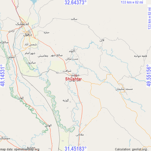
Shūshtar GPS coordinates[2]
32° 2' 58.992" North, 48° 50' 54.348" East
| Map corner | latitude | longitude |
|---|---|---|
| Upper-left | 32.64373°, | 48.14531° |
| Center: | 32.04972°, | 48.84843° |
| Lower-right: | 31.45183°, | 49.55156° |
| Map W x H: | 132.5×132.5 km | = 82.3×82.3mi |
| max Lat: | 39.6482° ⇑68.9% North |
| Shūshtar: | 32.04972° |
| min Lat: | ⇓31.1% South 25.2919° |
| min Long | Shūshtar | max Long |
| 44.38416° | 48.84843° | 61.9965° |
| W 26.8%⇐ | ⇒73.2% E |
Elevation
Elevation of Shūshtar is 50 m = 164 ft, and this is 999 m = 3278 ft below average elevation for this country.
| Max E: |
2564 m = 8412 ft | 84.4% |
| Avg. | 1049 m = 3442 ft | |
| Shūshtar | 50 m = 164 ft | |
Min E: |
-24 m = -79 ft | 15.6% |
See also: Shūshtar elevation on elevation.city.
Geographical zone
Shūshtar is located in North temperate zone (between Tropic of Cancer and the Arctic Circle). Distance of this Northern Tropic circle is 957.7 km =595.1 mi to South.| Distance of | km | miles | from Shūshtar |
|---|---|---|---|
| North Pole | 6443.5 | 4003.8 | to North |
| Arctic Circle | 3837.6 | 2384.6 | to North |
| Tropic Cancer | 957.7 | 595.1 | to South |
| Equator | 3563.6 | 2214.3 | to South |


Nearby cities:
15 places around Shūshtar: (largest is in red/bold)
• Ahvaz
82.7 km =51.4 mi,  190°
190°
• Andīmeshk
65.3 km =40.6 mi,  314°
314°
• Dasht-e Lati
38.7 km =24 mi,  36°
36°
• Dezful
55.6 km =34.5 mi, 311°
• Haftkel
93 km =57.8 mi,  136°
136°
• Hoveyzeh
98.1 km =61 mi,  228°
228°
• Jongīyeh
91 km =56.5 mi, 193°
• Masjed Soleymān
44.8 km =27.8 mi,  106°
106°
• Mollās̄ānī
51.8 km =32.2 mi,  176°
176°
• Qal‘eh-ye Khvājeh
58.8 km =36.5 mi,  72°
72°
• Rāmhormoz
111.5 km =69.3 mi, 140°
• Shahrak-e Kūlūrī
49 km =30.4 mi, 313°
• Shūsh
59.2 km =36.8 mi,  285°
285°
• Sūsangerd
82.5 km =51.3 mi, 229°
• sedeyen-e Yek
76.5 km =47.5 mi, 182°
Sources, notices
• [Note1] Compared only with cities in Iran existing in our database
• [Src1] Map data: © OpenStreetMap contributors (CC-BY-SA)
• [Src2] Other city data from geonames.org with taken over terms of usage.
• [Src3] Geographical zone / Annual Mean Temperature by Robert A. Rohde @ Wikipedia
