Hoveyzeh geodata
Hoveyzeh (Khuzestan) is a seat of a second-order administrative division; located in Iran in Asia/Tehran (GMT+3.5) time zone. In our database, there are 232 cities with bigger population. Compared to other cities in Iran, 73% of cities are located further ↑North; 81.4% of cities are located further →East and 90.2% of cities have higher elevation than Hoveyzeh. Note1


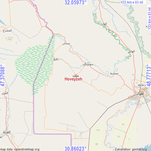
Hoveyzeh GPS coordinates[2]
31° 27' 42.84" North, 48° 4' 26.4" East
| Map corner | latitude | longitude |
|---|---|---|
| Upper-left | 32.05973°, | 47.37088° |
| Center: | 31.4619°, | 48.074° |
| Lower-right: | 30.86023°, | 48.77713° |
| Map W x H: | 133.4×133.4 km | = 82.9×82.9mi |
| max Lat: | 39.6482° ⇑73% North |
| Hoveyzeh: | 31.4619° |
| min Lat: | ⇓27% South 25.2919° |
| min Long | Hoveyzeh | max Long |
| 44.38416° | 48.074° | 61.9965° |
| W 18.6%⇐ | ⇒81.4% E |
Elevation
Elevation of Hoveyzeh is 15 m = 49 ft, and this is 1034 m = 3392 ft below average elevation for this country.
| Max E: |
2564 m = 8412 ft | 90.2% |
| Avg. | 1049 m = 3442 ft | |
| Hoveyzeh | 15 m = 49 ft | |
Min E: |
-24 m = -79 ft | 9.8% |
See also: Iran elevation on elevation.city.
Geographical zone
Hoveyzeh is located in North temperate zone (between Tropic of Cancer and the Arctic Circle). Distance of this Northern Tropic circle is 892.3 km =554.4 mi to South.| Distance of | km | miles | from Hoveyzeh |
|---|---|---|---|
| North Pole | 6508.8 | 4044.4 | to North |
| Arctic Circle | 3902.9 | 2425.1 | to North |
| Tropic Cancer | 892.3 | 554.4 | to South |
| Equator | 3498.2 | 2173.7 | to South |


Nearby cities:
15 places around Hoveyzeh: (largest is in red/bold)
• Abadan
126.8 km =78.8 mi,  170°
170°
• Ahvaz
60.1 km =37.3 mi,  105°
105°
• Andīmeshk
114.2 km =71 mi,  13°
13°
• Dasht-e Lati
136.3 km =84.7 mi,  44°
44°
• Dezful
106.9 km =66.4 mi,  17°
17°
• Jongīyeh
56.4 km =35 mi, 113°
• Khorramshahr
114 km =70.8 mi, 174°
• Masjed Soleymān
127.8 km =79.4 mi,  65°
65°
• Mollās̄ānī
78.2 km =48.6 mi,  79°
79°
• Shahrak-e Kūlūrī
105.9 km =65.8 mi, 20°
• Shādegān
106.5 km =66.2 mi,  148°
148°
• Shūsh
83 km =51.6 mi, 11°
• Shūshtar
98.1 km =61 mi,  48°
48°
• Sūsangerd
15.7 km =9.8 mi, 44°
• sedeyen-e Yek
71.5 km =44.4 mi,  98°
98°
Sources, notices
• [Note1] Compared only with cities in Iran existing in our database
• [Src1] Map data: © OpenStreetMap contributors (CC-BY-SA)
• [Src2] Other city data from geonames.org with taken over terms of usage.
• [Src3] Geographical zone / Annual Mean Temperature by Robert A. Rohde @ Wikipedia
