Moḩammadābād geodata
Moḩammadābād (Kerman) is a seat of a second-order administrative division; located in Iran in Asia/Tehran (GMT+3.5) time zone. In our database, there are 232 cities with bigger population. Compared to other cities in Iran, 90.2% of cities are located further ↑North; 91.8% of cities are located further ←West and 71.9% of cities have higher elevation than Moḩammadābād. Note1


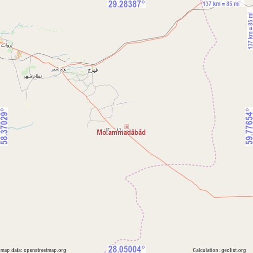
Moḩammadābād GPS coordinates[2]
28° 40' 7.572" North, 59° 4' 24.276" East
| Map corner | latitude | longitude |
|---|---|---|
| Upper-left | 29.28387°, | 58.37029° |
| Center: | 28.66877°, | 59.07341° |
| Lower-right: | 28.05004°, | 59.77654° |
| Map W x H: | 137.2×137.2 km | = 85.3×85.3mi |
| max Lat: | 39.6482° ⇑90.2% North |
| Moḩammadābād: | 28.66877° |
| min Lat: | ⇓9.8% South 25.2919° |
| min Long | Moḩammadābā | max Long |
| 44.38416° | 59.07341° | 61.9965° |
| W 91.8%⇐ | ⇒8.2% E |
Elevation
Elevation of Moḩammadābād is 602 m = 1975 ft, and this is 447 m = 1467 ft below average elevation for this country.
| Max E: |
2564 m = 8412 ft | 71.9% |
| Avg. | 1049 m = 3442 ft | |
| Moḩammadābād | 602 m = 1975 ft | |
Min E: |
-24 m = -79 ft | 28.1% |
See also: Iran elevation on elevation.city.
Geographical zone
Moḩammadābād is located in North temperate zone (between Tropic of Cancer and the Arctic Circle). Distance of this Northern Tropic circle is 581.7 km =361.5 mi to South.| Distance of | km | miles | from Moḩammadābād |
|---|---|---|---|
| North Pole | 6819.4 | 4237.4 | to North |
| Arctic Circle | 4213.5 | 2618.1 | to North |
| Tropic Cancer | 581.7 | 361.5 | to South |
| Equator | 3187.7 | 1980.7 | to South |


Nearby cities:
15 places around Moḩammadābād: (largest is in red/bold)
• Bam
85 km =52.8 mi,  304°
304°
• Dalgān
136.9 km =85.1 mi,  164°
164°
• Eslāmābād
127 km =78.9 mi,  235°
235°
• Fahraj
36.3 km =22.6 mi,  329°
329°
• Fāryāb
191 km =118.7 mi,  250°
250°
• Jīroft
130 km =80.8 mi,  270°
270°
• Kahnūj
156.3 km =97.1 mi, 239°
• Khāsh
215.3 km =133.8 mi,  103°
103°
• Manūjān
208.5 km =129.6 mi,  227°
227°
• Narmāshīr
48.3 km =30 mi,  310°
310°
• Noşratābād
162.9 km =101.2 mi,  32°
32°
• Qal‘eh Ganj
172.9 km =107.4 mi,  222°
222°
• Rābor
221.2 km =137.4 mi,  288°
288°
• Zahedan
196.7 km =122.2 mi,  62°
62°
• ‘Anbarābād
121.6 km =75.6 mi,  259°
259°
Sources, notices
• [Note1] Compared only with cities in Iran existing in our database
• [Src1] Map data: © OpenStreetMap contributors (CC-BY-SA)
• [Src2] Other city data from geonames.org with taken over terms of usage.
• [Src3] Geographical zone / Annual Mean Temperature by Robert A. Rohde @ Wikipedia
