Eslāmābād geodata
Eslāmābād (Kerman) is a seat of a second-order administrative division; located in Iran in Asia/Tehran (GMT+3.5) time zone. In our database, there are 232 cities with bigger population. Compared to other cities in Iran, 92.5% of cities are located further ↑North; 88.2% of cities are located further ←West and 73.5% of cities have higher elevation than Eslāmābād. Note1


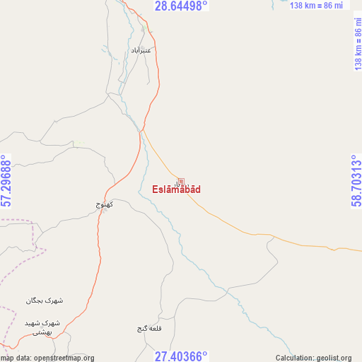
Eslāmābād GPS coordinates[2]
28° 1' 33.996" North, 58° 0' 0" East
| Map corner | latitude | longitude |
|---|---|---|
| Upper-left | 28.64498°, | 57.29688° |
| Center: | 28.02611°, | 58° |
| Lower-right: | 27.40366°, | 58.70313° |
| Map W x H: | 138×138 km | = 85.7×85.7mi |
| max Lat: | 39.6482° ⇑92.5% North |
| Eslāmābād: | 28.02611° |
| min Lat: | ⇓7.5% South 25.2919° |
| min Long | Eslāmābād | max Long |
| 44.38416° | 58° | 61.9965° |
| W 88.2%⇐ | ⇒11.8% E |
Elevation
Elevation of Eslāmābād is 487 m = 1598 ft, and this is 562 m = 1844 ft below average elevation for this country.
| Max E: |
2564 m = 8412 ft | 73.5% |
| Avg. | 1049 m = 3442 ft | |
| Eslāmābād | 487 m = 1598 ft | |
Min E: |
-24 m = -79 ft | 26.5% |
See also: Iran elevation on elevation.city.
Geographical zone
Eslāmābād is located in North temperate zone (between Tropic of Cancer and the Arctic Circle). Distance of this Northern Tropic circle is 510.3 km =317.1 mi to South.| Distance of | km | miles | from Eslāmābād |
|---|---|---|---|
| North Pole | 6890.9 | 4281.8 | to North |
| Arctic Circle | 4285 | 2662.6 | to North |
| Tropic Cancer | 510.3 | 317.1 | to South |
| Equator | 3116.2 | 1936.3 | to South |


Nearby cities:
15 places around Eslāmābād: (largest is in red/bold)
• Arzū’īyeh
166 km =103.1 mi,  286°
286°
• Bam
125 km =77.7 mi,  16°
16°
• Dalgān
154.6 km =96.1 mi,  113°
113°
• Fahraj
134.3 km =83.5 mi,  40°
40°
• Fāryāb
75.8 km =47.1 mi,  276°
276°
• Jīroft
76.8 km =47.7 mi,  340°
340°
• Kahnūj
30.6 km =19 mi,  254°
254°
• Manūjān
84.6 km =52.6 mi,  215°
215°
• Moḩammadābād
127 km =78.9 mi,  55°
55°
• Mīnāb
134.2 km =83.4 mi, 222°
• Narmāshīr
123.5 km =76.7 mi,  33°
33°
• Qal‘eh Ganj
57.1 km =35.5 mi,  191°
191°
• Rūdān
102.7 km =63.8 mi,  230°
230°
• Sardasht
174.9 km =108.7 mi,  183°
183°
• ‘Anbarābād
52.2 km =32.4 mi, 343°
Sources, notices
• [Note1] Compared only with cities in Iran existing in our database
• [Src1] Map data: © OpenStreetMap contributors (CC-BY-SA)
• [Src2] Other city data from geonames.org with taken over terms of usage.
• [Src3] Geographical zone / Annual Mean Temperature by Robert A. Rohde @ Wikipedia
