Dalgān geodata
Dalgān (Sistan and Baluchestan) is a seat of a second-order administrative division; located in Iran in Asia/Tehran (GMT+3.5) time zone. In our database, there are 232 cities with bigger population. Compared to other cities in Iran, 94.8% of cities are located further ↑North; 93.4% of cities are located further ←West and 76% of cities have higher elevation than Dalgān. Note1


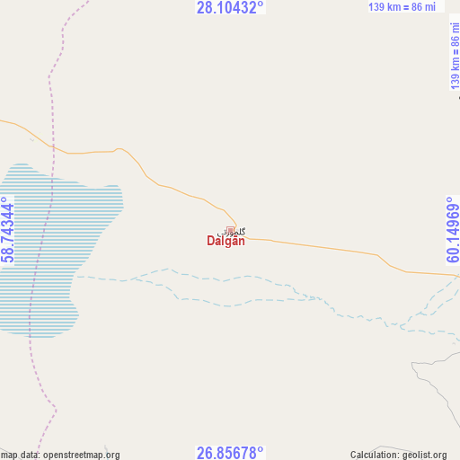
Dalgān GPS coordinates[2]
27° 28' 56.352" North, 59° 26' 47.616" East
| Map corner | latitude | longitude |
|---|---|---|
| Upper-left | 28.10432°, | 58.74344° |
| Center: | 27.48232°, | 59.44656° |
| Lower-right: | 26.85678°, | 60.14969° |
| Map W x H: | 138.7×138.7 km | = 86.2×86.2mi |
| max Lat: | 39.6482° ⇑94.8% North |
| Dalgān: | 27.48232° |
| min Lat: | ⇓5.2% South 25.2919° |
| min Long | Dalgān | max Long |
| 44.38416° | 59.44656° | 61.9965° |
| W 93.4%⇐ | ⇒6.6% E |
Elevation
Elevation of Dalgān is 388 m = 1273 ft, and this is 661 m = 2169 ft below average elevation for this country.
| Max E: |
2564 m = 8412 ft | 76% |
| Avg. | 1049 m = 3442 ft | |
| Dalgān | 388 m = 1273 ft | |
Min E: |
-24 m = -79 ft | 24% |
See also: Iran elevation on elevation.city.
Geographical zone
Dalgān is located in North temperate zone (between Tropic of Cancer and the Arctic Circle). Distance of this Northern Tropic circle is 449.8 km =279.5 mi to South.| Distance of | km | miles | from Dalgān |
|---|---|---|---|
| North Pole | 6951.3 | 4319.3 | to North |
| Arctic Circle | 4345.4 | 2700.1 | to North |
| Tropic Cancer | 449.8 | 279.5 | to South |
| Equator | 3055.7 | 1898.7 | to South |


Nearby cities:
15 places around Dalgān: (largest is in red/bold)
• Bam
209.7 km =130.3 mi,  329°
329°
• Eslāmābād
154.6 km =96.1 mi,  293°
293°
• Fahraj
172.2 km =107 mi,  341°
341°
• Fannūj
102.6 km =63.8 mi,  169°
169°
• Iranshahr
126.2 km =78.4 mi,  104°
104°
• Kahnūj
179.7 km =111.7 mi, 286°
• Khāsh
192.4 km =119.6 mi,  64°
64°
• Manūjān
192.1 km =119.4 mi,  267°
267°
• Moḩammadābād
136.9 km =85.1 mi, 344°
• Narmāshīr
179.1 km =111.3 mi, 335°
• Nīkshahr
159.1 km =98.9 mi,  151°
151°
• Qal‘eh Ganj
154.5 km =96 mi, 271°
• Qaşr-e Qand
188.7 km =117.3 mi,  136°
136°
• Sardasht
190.9 km =118.6 mi,  233°
233°
• ‘Anbarābād
191.9 km =119.2 mi,  305°
305°
Sources, notices
• [Note1] Compared only with cities in Iran existing in our database
• [Src1] Map data: © OpenStreetMap contributors (CC-BY-SA)
• [Src2] Other city data from geonames.org with taken over terms of usage.
• [Src3] Geographical zone / Annual Mean Temperature by Robert A. Rohde @ Wikipedia
