Fahraj geodata
Fahraj (Kerman) is a seat of a second-order administrative division; located in Iran in Asia/Tehran (GMT+3.5) time zone. In our database, there are 232 cities with bigger population. Compared to other cities in Iran, 88.7% of cities are located further ↑North; 91.6% of cities are located further ←West and 69.6% of cities have higher elevation than Fahraj. Note1


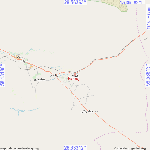
Fahraj GPS coordinates[2]
28° 57' 0.72" North, 58° 53' 6" East
| Map corner | latitude | longitude |
|---|---|---|
| Upper-left | 29.56363°, | 58.18188° |
| Center: | 28.9502°, | 58.885° |
| Lower-right: | 28.33312°, | 59.58813° |
| Map W x H: | 136.8×136.8 km | = 85×85mi |
| max Lat: | 39.6482° ⇑88.7% North |
| Fahraj: | 28.9502° |
| min Lat: | ⇓11.3% South 25.2919° |
| min Long | Fahraj | max Long |
| 44.38416° | 58.885° | 61.9965° |
| W 91.6%⇐ | ⇒8.4% E |
Elevation
Elevation of Fahraj is 680 m = 2231 ft, and this is 369 m = 1211 ft below average elevation for this country.
| Max E: |
2564 m = 8412 ft | 69.6% |
| Avg. | 1049 m = 3442 ft | |
| Fahraj | 680 m = 2231 ft | |
Min E: |
-24 m = -79 ft | 30.4% |
See also: Iran elevation on elevation.city.
Geographical zone
Fahraj is located in North temperate zone (between Tropic of Cancer and the Arctic Circle). Distance of this Northern Tropic circle is 613 km =380.9 mi to South.| Distance of | km | miles | from Fahraj |
|---|---|---|---|
| North Pole | 6788.1 | 4217.9 | to North |
| Arctic Circle | 4182.2 | 2598.7 | to North |
| Tropic Cancer | 613 | 380.9 | to South |
| Equator | 3219 | 2000.2 | to South |


Nearby cities:
15 places around Fahraj: (largest is in red/bold)
• Bam
54.2 km =33.7 mi,  288°
288°
• Dalgān
172.2 km =107 mi,  161°
161°
• Eslāmābād
134.3 km =83.5 mi,  220°
220°
• Fāryāb
187.2 km =116.3 mi,  239°
239°
• Jīroft
115.5 km =71.8 mi,  254°
254°
• Kahnūj
160.5 km =99.7 mi,  226°
226°
• Kūh Sefīd
205.6 km =127.8 mi,  280°
280°
• Manūjān
218.7 km =135.9 mi, 218°
• Moḩammadābād
36.3 km =22.6 mi,  149°
149°
• Narmāshīr
18.2 km =11.3 mi,  270°
270°
• Noşratābād
149.9 km =93.1 mi,  45°
45°
• Qal‘eh Ganj
186.6 km =115.9 mi,  211°
211°
• Rābor
195.3 km =121.4 mi, 281°
• Zahedan
201.3 km =125.1 mi,  72°
72°
• ‘Anbarābād
114.1 km =70.9 mi, 242°
Sources, notices
• [Note1] Compared only with cities in Iran existing in our database
• [Src1] Map data: © OpenStreetMap contributors (CC-BY-SA)
• [Src2] Other city data from geonames.org with taken over terms of usage.
• [Src3] Geographical zone / Annual Mean Temperature by Robert A. Rohde @ Wikipedia
